# Map update request for Ille-et-Vilaine (35)
**URL:** https://www.waze.com/discuss/t/demande-mise-a-jour-carte-ille-et-vilaine-35/392574
**Category:** Demande de mise à jour
**Created:** [October 17, 2025, 5:54pm UTC](https://www.waze.com/discuss/t/demande-mise-a-jour-carte-ille-et-vilaine-35/392574 "2025-10-17T17:54:00Z")
**Posts on this page:** 4
**Page:** 1
### Author:  [@0a5430add56949afafc976a6fd355453](https://www.waze.com/discuss/u/0a5430add56949afafc976a6fd355453)
#### Post date: [October 17, 2025, 5:54pm UTC](https://www.waze.com/discuss/t/demande-mise-a-jour-carte-ille-et-vilaine-35/392574/1 "2025-10-17T17:54:00Z")
Hello editors, my home is also a guest house, L’Etang de Vie at the Moulin de Saint François 35133 Landéan. There are 2 possible access routes (via the forest and the Carrefour du Père Tacot / and the only one mentioned by Waze via Le Grésillon ID 328308660). Only one is currently listed, which forces people to take detours. A node is visible and should also be deleted, ID: 263764692. Could you provide both access options? thanks in advance
---
### Author:  [@alfer35](https://www.waze.com/discuss/u/alfer35)
#### Post date: [October 18, 2025, 8:40am UTC](https://www.waze.com/discuss/t/demande-mise-a-jour-carte-ille-et-vilaine-35/392574/2 "2025-10-18T08:40:41Z")
Hello,
Your request is not in the right forum; here is the link to the update forum: [https://www.waze.com/discuss/c/editors/france/demande-de-mise-a-jour/4269](https://www.waze.com/discuss/c/editors/france/demande-de-mise-a-jour/4269)
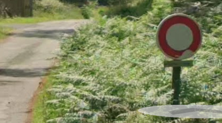
I tried to update it, but I noticed that the road starting from Carrefour du Père Tacot is PRIVATE (it exists on Waze) and, as a result, Waze will not prioritize routing through it over the Route du Grésillon.
---
### Author:  [@0a5430add56949afafc976a6fd355453](https://www.waze.com/discuss/u/0a5430add56949afafc976a6fd355453)
#### Post date: [October 18, 2025, 12:33pm UTC](https://www.waze.com/discuss/t/demande-mise-a-jour-carte-ille-et-vilaine-35/392574/3 "2025-10-18T12:33:21Z")
Thank you for taking the time to respond. The road is not private; it belongs to the National Forests Office (ONF). The sign indicates that it is a dead end, and it is actually the official road to reach my house, used daily by the post office to deliver my mail.
How can I change this private status, which is an error?
Thank you, and I will take a look at the link provided.
Sent from my iPhone
---
### Author:  [@alfer35](https://www.waze.com/discuss/u/alfer35)
#### Post date: [October 18, 2025, 2:21pm UTC](https://www.waze.com/discuss/t/demande-mise-a-jour-carte-ille-et-vilaine-35/392574/4 "2025-10-18T14:21:28Z")
Thanks for the clarification, I’m going to change this road into a public street. No need to go to the other forum; I’ve provided the link for a later update.