Could a local editor please review the road attributes and routing profile through Acol village ( The Street / Margate Hill/ Crispe Road area in Thanet, Kent)?
Issues:
There is an active 7.5t Traffic Regulation Order (TRO) through the village. Please ensure lorry/HGV routing restrictions are correctly applied to these segments.
The road is exceptionally narrow with traffic calming, no footpaths (including to and from the children’s play area) and residential properties on the edge. The app routinely routes heavy through-traffic and commuters cutting across from Columbus Avenue / Manston Business Park.
Please check that speed defaults, turn restrictions, and road width parameters accurately reflect the physical bottlenecks through the village to prevent inappropriate shortcutting over the main A-road corridors (A299 / A256).
Thanks for your post. Lorries/HGVs are not supported by the Waze app, nor can we set weight/width restrictions so unfortunately will not be able to help with this.
Thanks for the quick reply! I fully understand that Waze doesn’t support specific HGV vehicle types or tonnage filters.
To clarify, my request is also regarding general car and light commercial cut-through traffic using the village as a shortcut to bypass main routes.
Could you please review the segment attributes through Acol (Crispe Road, The Street, and Margate Hill) to ensure the physical bottlenecks are accurately reflected?
Specifically, applying appropriate segment speed defaults or routing penalties that reflect the narrow, single-lane residential nature of these streets so the engine naturally prefers keeping transit traffic on the primary A-road corridor (A299 / A256) instead of directing commuter shortcuts through the village.
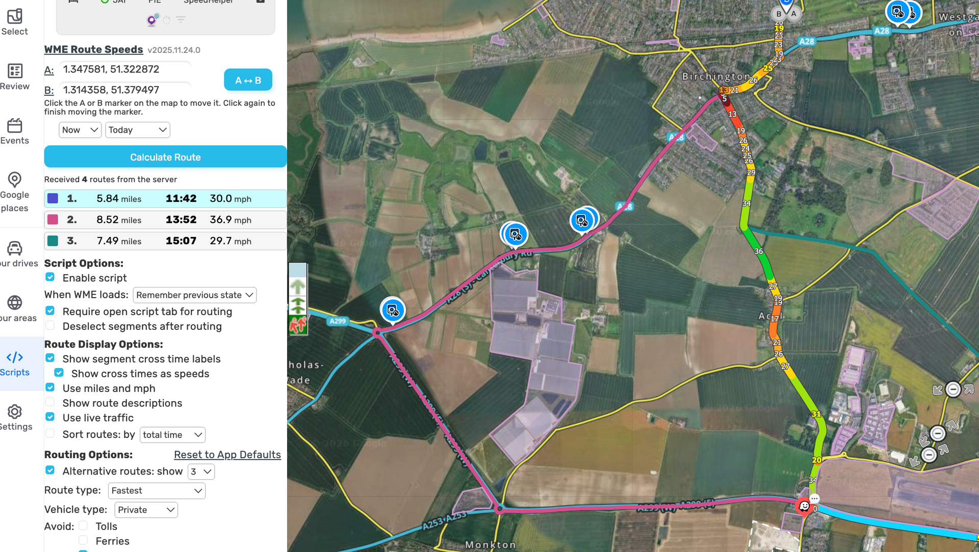
Since it’s a public road Waze will use it as an alternative route. Using the village as a route saves 3 miles and 2 minutes despite all the traffic calming measures (as seen below). I can only really recommend petitioning the council for further traffic calming measures or restrictions as we do not restrict legal routes.
Thanks again - could you please double-check that the junction nodes (specifically where Margate Hill and Crispe Road join the main routes) have appropriate turn penalties applied, and that Crispe Road, The Street, and Margate Hill are categorized as narrow residential local roads rather than higher-priority transit segments?
We’re just trying to ensure any natural junction wait times or narrow-street delays are fully accounted for in the baseline ETA.