Waze for responders
I use Waze every single day at work -- I'm a Safety Service patrolman for my local DOT, driving up and down highways looking for people in trouble. The crowdsourced data Waze collects on the locations of stopped vehicles are invaluable to my ability to discover where traffic hazards are, and I use this data to help remove those hazards. When you complain about road debris or a vehicle in a bad spot, I'm the one removing that. Several other drivers with our service run Waze because it is just so valuable having a heads up display of nearby traffic and road hazards.
There's some features and corrections that would make life incredibly better for those of us using the back-end of the system like this.
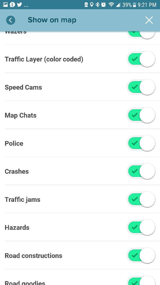
1. Add a finer control of which type of things appear on the map. I don't need to see construction crews, or weather hazards, or missing signs. I only need to see road debris, stopped vehicles, roadside assistance requests, and police. But currently, the options don't give you the choice of specific things you would like to see. Less clutter makes for a more efficient workflow.
2. Roadside help requests form makes no mention of state run patrol services designed to get people going for free. In many states, you call 911 or another number to summon the state services, during specific hours. In Massachusetts, it is 6-10am, 3-7pm weekdays via calling 911. State safety service patrols exist throughout much of the United States, with completely free services designed to clear roadways expediently. It would make sense to add this kind of information somewhere to the request assistance forms. For now, I just scan Fellow Wazer requests if they come in and see if anyone there needs help, but most of the services I do are for non wazers that as re discovered through stopped vehicle on shoulder reports.
3. Pay to remove advertisements. They sometimes get in the way. I'd love to just dismiss them and get them out of there.
4. Maybe have a first responder mode with the ability to set a patrol area to monitor, and get notifications if any new item appears within that area?
I should mention some of the testimonials of how Waze helps responders in times of need. If someone calls 911 with, say, a car crash with injuries, but they don't know where on the highway they are, the location that gets referenced to the state police is very vague, and it may take resources a VERY long time to arrive on scene and start assisting the injured. Additionally, extra time with blocked lanes or crashes means a cascading effect with regional traffic. By having Waze up and available, I can see where people report crashes with a high degree of precision, and make educated guesses as to where the people are who need us the most.
I do understand Waze has the CCP program they are trying to market to regional dispatch centers, but us boots on the ground need a system to see in real time where we can decide where to drive to and what to check on. CCP is nice, but it doesn't solve the problem for patrol-route style assets like we are, only for dispatched assets.
There's some features and corrections that would make life incredibly better for those of us using the back-end of the system like this.
1. Add a finer control of which type of things appear on the map. I don't need to see construction crews, or weather hazards, or missing signs. I only need to see road debris, stopped vehicles, roadside assistance requests, and police. But currently, the options don't give you the choice of specific things you would like to see. Less clutter makes for a more efficient workflow.
2. Roadside help requests form makes no mention of state run patrol services designed to get people going for free. In many states, you call 911 or another number to summon the state services, during specific hours. In Massachusetts, it is 6-10am, 3-7pm weekdays via calling 911. State safety service patrols exist throughout much of the United States, with completely free services designed to clear roadways expediently. It would make sense to add this kind of information somewhere to the request assistance forms. For now, I just scan Fellow Wazer requests if they come in and see if anyone there needs help, but most of the services I do are for non wazers that as re discovered through stopped vehicle on shoulder reports.
3. Pay to remove advertisements. They sometimes get in the way. I'd love to just dismiss them and get them out of there.
4. Maybe have a first responder mode with the ability to set a patrol area to monitor, and get notifications if any new item appears within that area?
I should mention some of the testimonials of how Waze helps responders in times of need. If someone calls 911 with, say, a car crash with injuries, but they don't know where on the highway they are, the location that gets referenced to the state police is very vague, and it may take resources a VERY long time to arrive on scene and start assisting the injured. Additionally, extra time with blocked lanes or crashes means a cascading effect with regional traffic. By having Waze up and available, I can see where people report crashes with a high degree of precision, and make educated guesses as to where the people are who need us the most.
I do understand Waze has the CCP program they are trying to market to regional dispatch centers, but us boots on the ground need a system to see in real time where we can decide where to drive to and what to check on. CCP is nice, but it doesn't solve the problem for patrol-route style assets like we are, only for dispatched assets.
-
MoveOverSlowDown
- Posts: 11
- Has thanked: 5 times
- Been thanked: 16 times
POSTER_ID:17206661
1
Re: Waze for responders