Hello, I’m new here and I want to add a private road to the map. It was recently constructed and added to google maps, but I’ve tried on Waze and it says “That change isn’t allowed at this time and won’t be sent for review”. It shows on the satellite, could someone help?
Hi @world_n7sxs77v,
Which location are we talking about?

They are shown on google. If you search Stump - Wilderness Reserve. The one on the left will pop up.
Moving this post to UK forum for better assistance from the local editor community.
I have found and replied to your User Report. This area of private roads and places has been added to Waze.
Hi Ian,
Thanks for your help at Sibton, it is really appreciated and hopefully will help our guests to find the properties.
I have a few more sites that need mapping assistance in this area. Would you be able to help? I have logged issue reports at Chapel Barn - Wilderness Reserve. The below screenshot should help understand these issues. I would really appreciate your help.


Hi Ian,
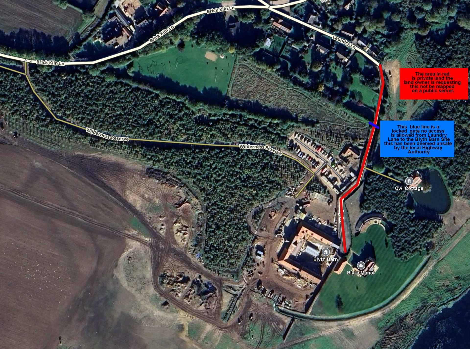
Thanks for your help on this site. We have had some issues with guests trying to utilise Laundry Lane, this is deemed unsafe by the local highway authority and there is a locked gate halfway along the lane (recently installed). Is there a way that you can block access down this lane for any directions to Blyth Barn, Blyth Manor or Owl Cottage? Ideally the private road ownership on Laundry Lane would not be mapped. See the following screenshot.
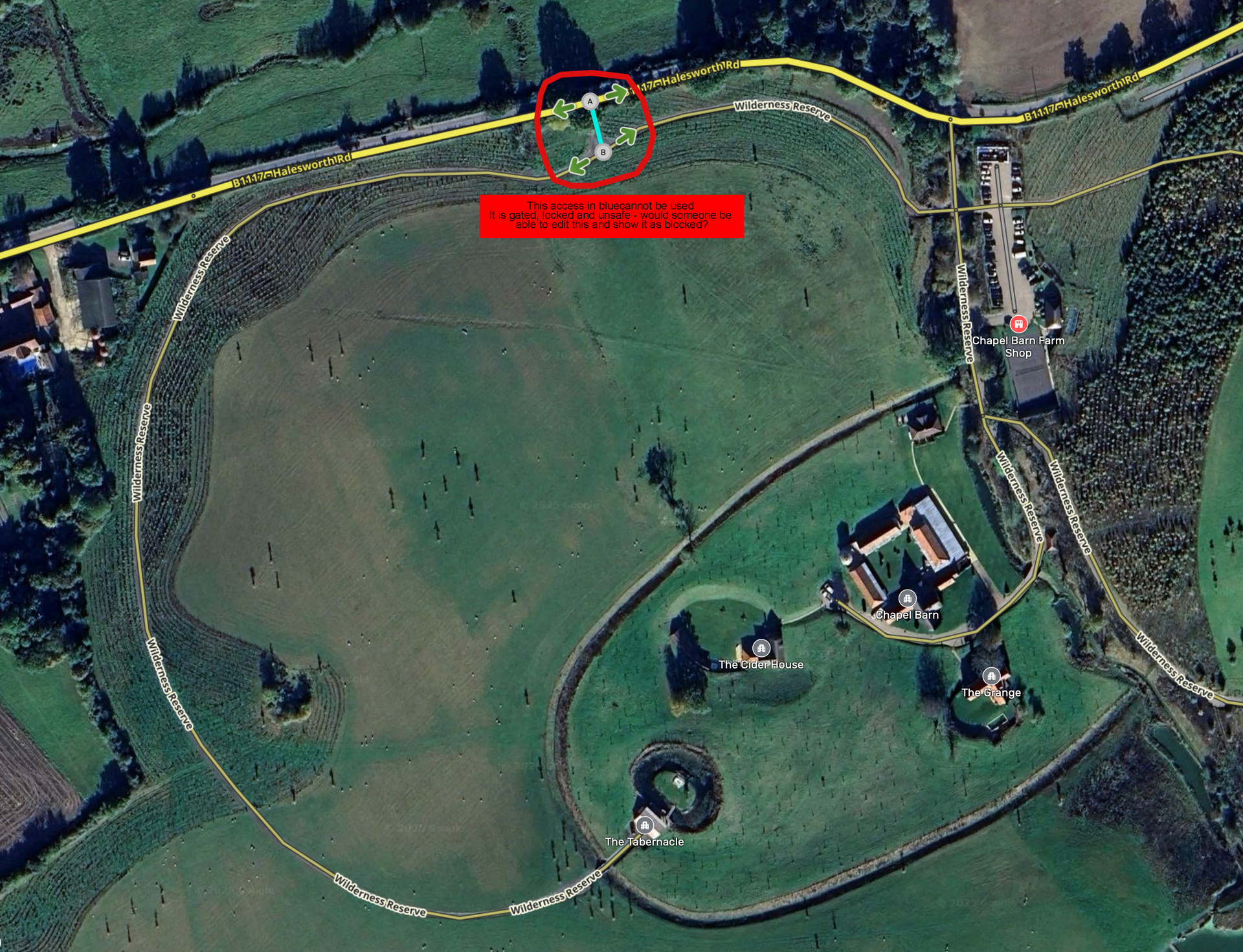
Hi Ian,
Thanks for all your help on this site. It is very much appreciated. We are now seeking to block in the access shown A-B and hedging across on request of the locals. All access will then be through the western access off of Brick Kiln Lane, show far left on this photo. Are you able to remove the mapping segment shown A-B (next to Mossie)? This would be very helpful.
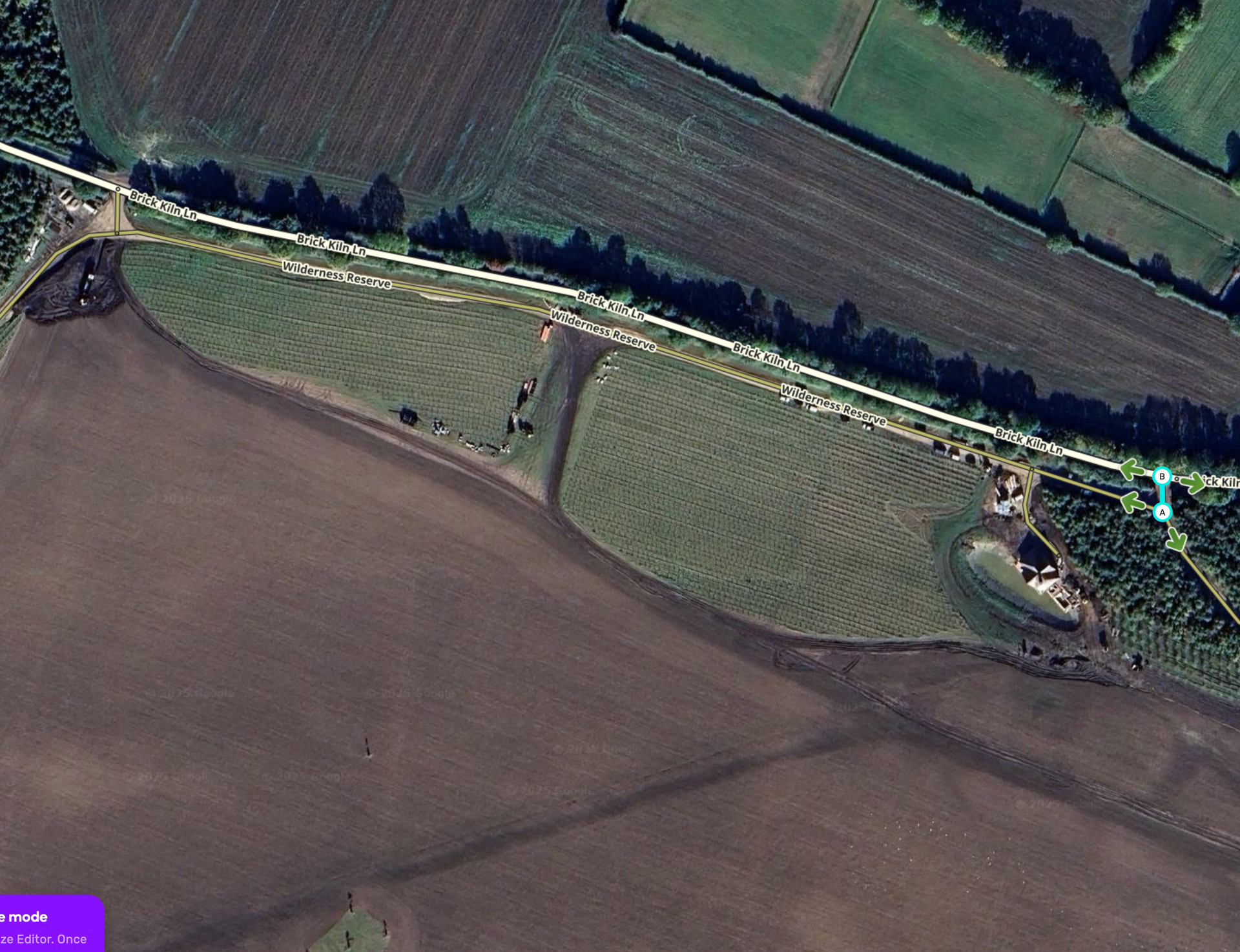
I have changed this to show it is closed to all traffic.
Ian
Hi Ian, Thank you so much for your help so far. We have just built a bridge and road to connect to the Halesworth road, and all traffic points are now closed off of Brick Kiln Lane. Are you able to change the Waze mapping to reflect this? The satellite hasn’t been updated but I can provide imagery if needed. See attached map.
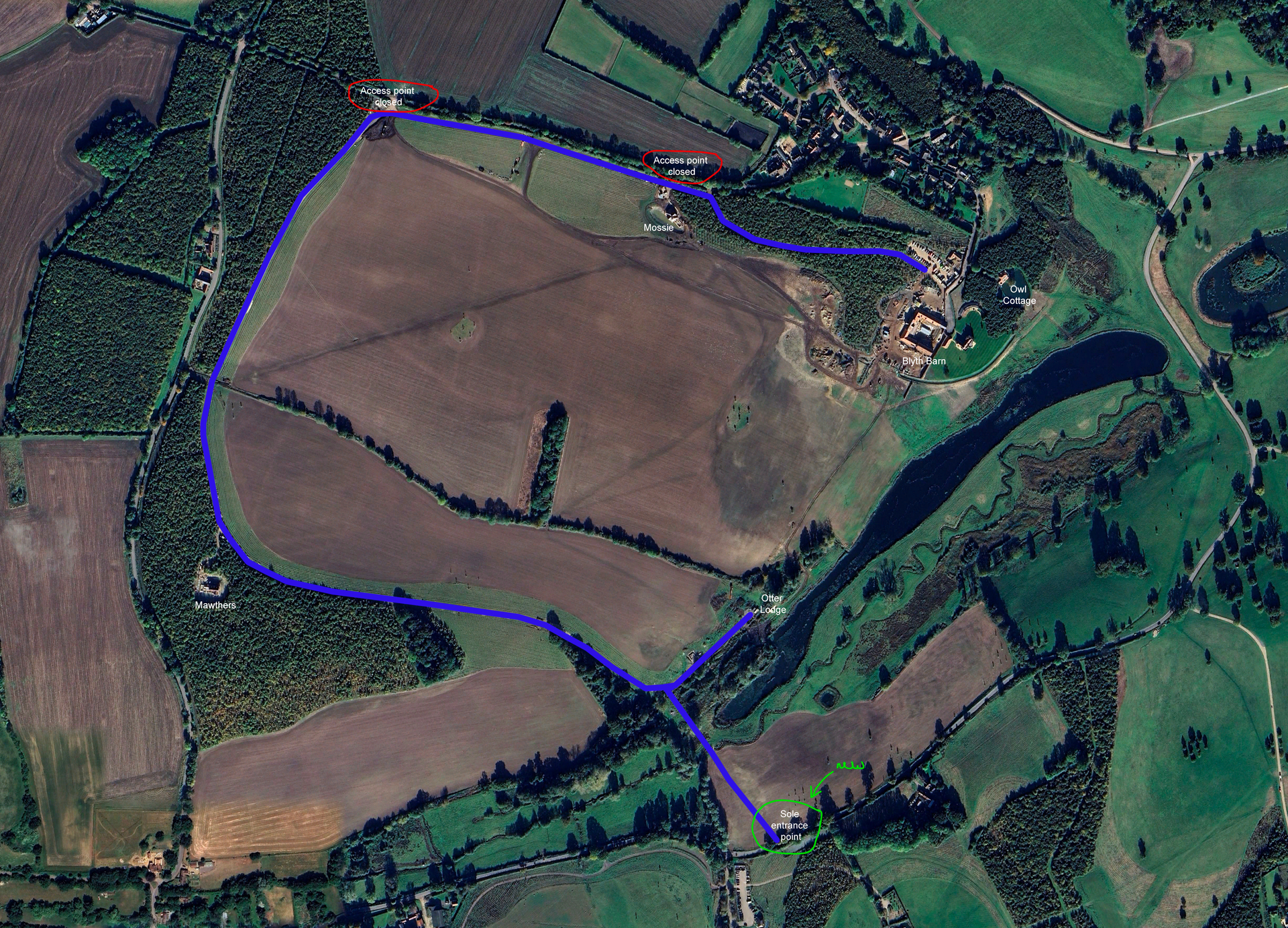
I have made the reqested corrections and these will appear in the live map in a few days when it next updates.