I can’t imagine why having ramp in the middle of the route would effect the routing. Besides the alternative has a ramp here.
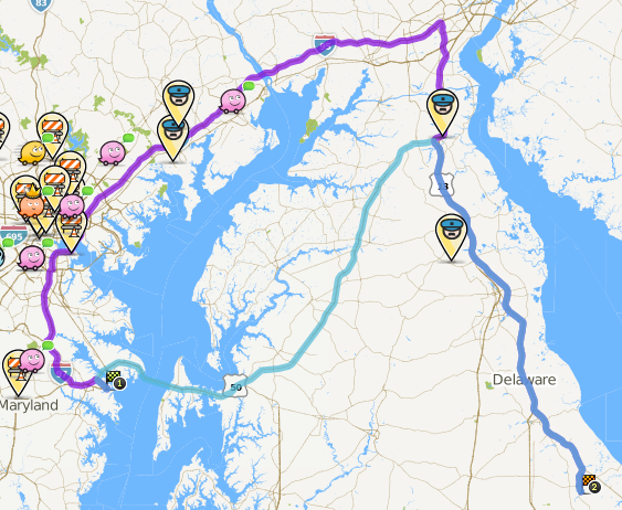
The two routes from the bridge show that its at least 50 minutes and 80 miles longer to go around the bay than over the bridge. Shouldn’t the times given by waze for the alternative routes already take into account the various routing penalties?
I don’t believe the ETA includes any of the penalty time for junctions, and that it only totals up transit times based on current/historical conditions.
All I can really suggest is to clean up the intended route and see what happens. If it still wants to go the long way round we’ll have a fairly strong indicator that in long route mode road typing really matters and it will strongly prefer to stay on Freeway.
How long to map updates take to come live? I see some red roads on the map right after the bridge and it seems they are roads people fixed but they have not updated?
Also I did a lot of fixes on roads near my home in NJ and am wondering when they will be fixed
Now that I’ve got my 4+ status I’ve gone through that first route cleaning up all the minor issue, removed extraneous junctions, etc, from A to B. I did not work the reverse route, so the split roads in the other direction have only minor work done.
Yeah no editing issues along the route to Milton. There were problems but nothing that would have prevented routing from the bridge, obviously since live map gave a route. The question now is if the cleanup makes enough of a difference to make it a preferred or even alternate from Annapolis.
I’ve deleted them. I’m thinking about complicating the Chesapeake Bay Bridge though. The problem is that the northern span is three lanes while the southern span is two lanes. Thus, when the traffic is heavy eastbound, one lane of the northern span is used for eastbound traffic. Currently if you travel eastbound on the northern span, waze has problems. I will probably add the crossover roads and make the northern span two way. The crossover roads should likely be parking lot roads or something like that so that waze won’t route eastbound on the northern span, but if you go that way enable waze to route you off the bridge.
Just checked for myself, and yup it seems to be working. This brings up a lot of questions and concerns for me now, since what I did (restricted all turns and re-enabled) seems excessive to make the route work over something that didn’t seem to have any major issues after the first pass through.
Unsurprisingly the reverse route does not work as I didn’t do much on the westbound bits where the roads were split.
Note the HOV2 Lane, which is set as 2-way. It’s not disconnected at either end, so routing won’t take you on it, but if you go that way, Waze seems to always know which road you’re on.