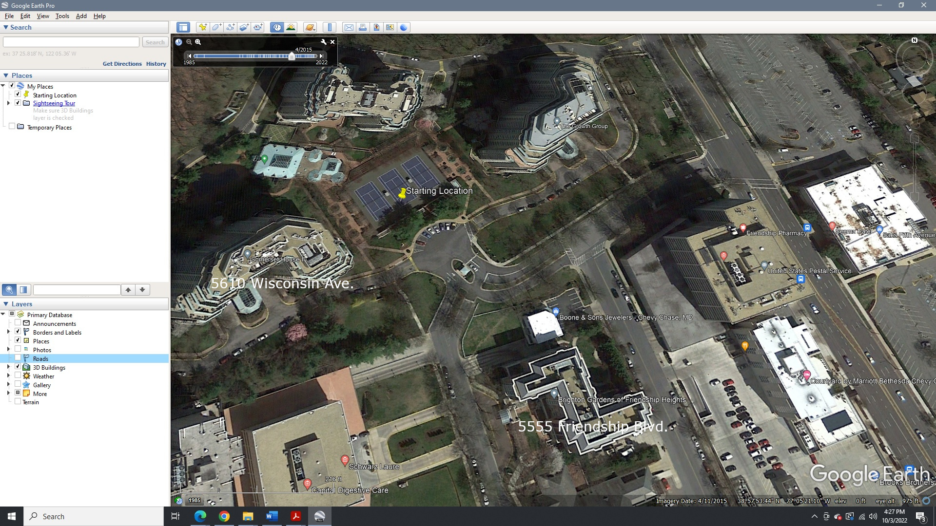
My community has a gated entrance that can be entered only with a transponder. There’s no intercom to reach an attendant. On Google Maps I was able to get this entrance marked one-way outbound, so no one will be routed in through there, even if their destination is within the community, but anyone exiting the community may be routed out that way. Can the entrance be marked one-way on Waze also? The coordinates of the entrance in question are 38.966260, -77.088593.
From Streetview (Nov 2021) that segment is 2-way and it’s marked “Private” - but so is the entrance off of Somerset Terrace … but it looks like there is a guard station there. Shall we make that entrance as preferred for visitors?
Besides the gated entrance on Wisconsin Avenue, the subject of my original post, there are two other gated entrances on Somerset Terrace, a short distance from each other. Those are:
Guard house entrance at 38.964886, -77.089665, usable by anyone.
Friendship Boulevard entrance at 38.964652, -77.089750, a stone’s throw from the guardhouse. This one requires a transponder to pass from Friendship Blvd. to Somerset Terrace, but anyone can pass the other way.
What would be the effect of setting the guard house entrance as the preferred entrance? Would it stop any inbound routing through the Wisconsin Ave. entrance? Note also that the Friendship Blvd. entrance is an unusual case. It’s like the Wisconsin Ave. entrance in that it requires a transponder in one direction, but it isn’t an entrance to the community. It regulates traffic between Friendship Blvd., a public road, and Somerset Terrace, a road that’s used by the public but isn’t a public road. Rather, it’s a private road with an easement for public use. That’s why there can be a gate separating it from Friendship Blvd.
As it stands currently (before I make any recommended changes), all entrances are set to “Private” - the effect being, drivers with a valid destination within the community will be routed to use the nearest entrance.
In this case, where at some entrances an access card is required, it would be best to set the Guardhouse entrance for “Public” access and leave the other two as “Private.” One wouldn’t want to set the one gated entrance (the subject of your first post) to “Exit Only” since those with access cards would not be offered that entrance either.
The changes I make should take effect in a few days.
No changes have been made to the Friendship Blvd Entrance: it remains “Private”, accessible only using a key card. However it appears anyone can access that section from Willard Ave/ S Park Ave. Streetview doesn’t show any gated roadways there. As you stated, “anyone can pass from the other side.”
In addition, those without access cards will only be routed via the Guard House. Is that the desired effect?
In the Street View image taken at the north end of Friendship Blvd. before the car turned around, the Friendship Blvd. gate is visible, and beyond it is the Guard House. The Guard House entrance gate is on the far side of the Guard House, and the exit gate on the near side. Neither is visible in the picture.
Routing those without access cards (transponder in this case) via the Guard House is exactly the desired effect, but how do you distinguish who has a transponder?
Condo complex management isn’t concerned about transponder holders not being offered the Wisconsin Ave. or Friendship Blvd. entrances, because those people live or work here, and know how to get in.
It’s not a matter of knowing who has a transponder (as you note, residents know their way around the place), rather the general public (visitors, delivery services). We want to route them to entrances meant for them (i.e, the Guard House) and avoid the gates that open only for transponders.
We previously had it for “Majority Residents”, where residents were routed using the nearest entrance (which inconvenienced delivery drivers and visitors not knowing which gate is for them).
Again, it may take a day or 2 for these changes to be reflected in the app.
Here’s what I found from trying routes on the iOS app:
Routing from Capello Park (a few blocks north of this complex) to 5600 Wisconsin Ave., the route bypasses the Wisconsin Ave. gate, as desired.
To see if Waze will route outbound through the Wisconsin Ave. gate, I tried routing from 5600 Wisconsin Ave. to 5454 Wisconsin Ave., a few blocks south. The displayed route started on Wisconsin Ave., not at the location of 5600 Wisconsin inside the complex.
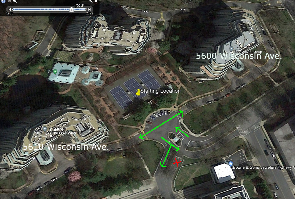
Routing from 5555 Friendship Blvd. (outside) to 5610 Wisconsin Ave.(inside) avoids the Friendship Blvd. gate, as desired. The reverse trip should go out through the Friendship Blvd. gate but doesn’t. Here’s historical Google Earth imagery that’s less obscured by foliage, showing the topology of the roads between those buildings. I wonder if the topology has to be corrected in the Waze database:
Thank you.
(1) 5600 Wisconsin Blvd not staring inside: perhaps you have a cached location for 5600 Wisconsin Blvd. please remove any instance of this address from your history / Saved Places (tap the 3 dots). Then perform a new search and resave.
If you have an old search result or Saved Place, drivers will be routed to the old location - Waze stores the Lat/Long of a search result and doesn’t perform a new query each time.
I’ll have to look further into the issue of the route starting out on Wisconsin Ave., and make sure I’ve cleared everything. For what it’s worth, when I pick an auto-complete, I always choose one with a pin marker, not with a clock(?).
The Friendship Blvd. gate should allow unrestricted traffic from Somerset Terrace to Friendship Boulevard, and no traffic in the other direction.
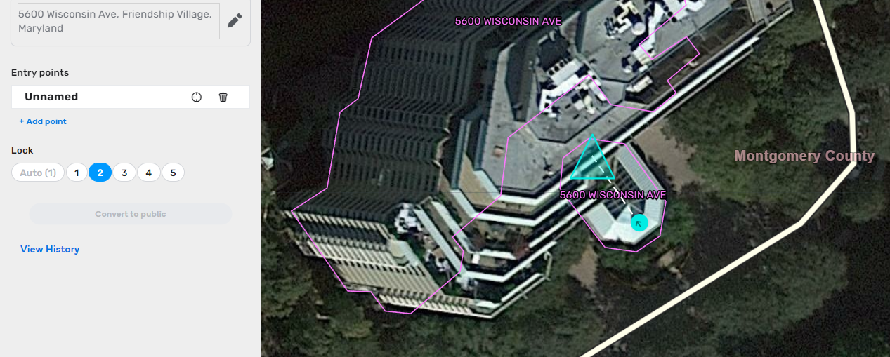
Given that Waze has a concept of private installations, is there a defined border for an installation? I’m asking because the Somerset Terrace side of the Friendship Blvd. gate is split between inside and outside the installation. The outbound half (toward Friendship Blvd.) is inside the installation. The inbound half (from Friendship Blvd.) is outside the installation, on the publicly-usable part of Somerset Terrace, but isn’t passable by the public, even though both sides are publicly accessible. Hopefully this is clear from the Google Earth imagery.
At this point, a picture is worth a thousand words. Please mark-up your Google Earth Image to help us understand what is needed,
As for the “pin” for the Wisconsin Ave address, you should delete all “pins” that are saved in the app, including the one with the “clock” (that indicates a selected destination in your app’s history). As mentioned earlier, waze caches the Lat/Long - there is no “F5” key to force a refresh. The “autocomplete” result may still use the cached location. We have a 'Waze Residential Point Place" here
Here’s the Guard House and Friendship Blvd. gate area marked with arrows showing allowed travel.
Right now when I ask for a route from 5610 Wisconsin Ave. to 5600 Wisconsin Ave., it takes me the long way around the ring road, making a right turn out of 5610. The double-headed arrow across the parking area is to show that vehicles can traverse it in both directions, so one can drive directly from 5610 to 5600.
Hello,
I was taking a look at this with Kodi75. I want to confirm I understand everything correctly. In the picture I posted below, the green routes are accessible to all traffic; and the red routes are only possible with a resident transponder, correct? This means that visitors must enter via Somerset Ter, but may exit via any point.
Thank you,
Jason
There is nothing with the way the ring road is mapped that prevents routing in either direction. When it comes to which direction Waze provides to you on a route, the Waze routing server has to make an assumption for your direction of travel. If you were last traveling southwest on the ring road, Waze will typically assume the same starting direction when you next request a route. It will recalculate if you instead start traveling in the other direction.