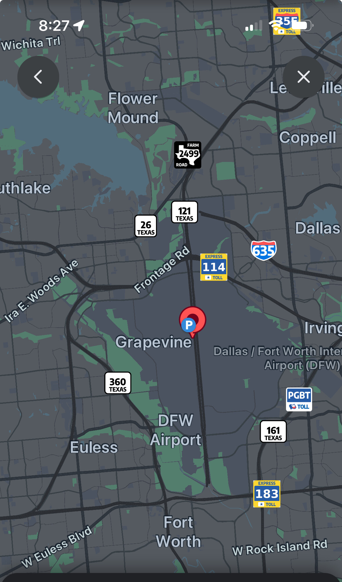
Apparently someone at Waze thinks that Grapevine Texas is in the MIDDLE OF AN INTERNATIONAL AIRPORT. Even their competitors (Apple & Google) know that grapevine isn’t. DFW airport is so big that it has its own zip code. :lol: (75261) It would be great if Waze could change that-----
Hello and thanks for reaching out. The short short answer here is that this isn’t something the volunteer map editors can adjust. The city labels are rendered as an aggregate center for the city information on the segments. In this case there is City of Grapevine (primary city and not airport) both to the west and north of the airport boundary so depending upon the map view you are experiencing the label may adjust over the airport property while also avoiding overlapping another label. On the airport we (Waze volunteer map editors) have adjusted businesses and road segments to ‘DFW Airport’ as the primary city as that is the mailing address per USPS. Road segments that fall within municipal boundaries that are overlapped by the airport are given a secondary city for search purposes.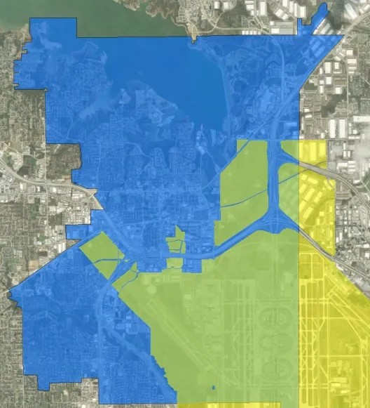
I’ve done an extensive ‘deep-dive’ for this area and hopefully I can share what I’ve learned. DFW Airport is roughly 27 square miles sitting atop five cities whose municipal boundaries meet (Coppell, Euless, Fort Worth, Grapevine, and Irving) and two counties that meet between Taxiways Kilo and Lima. While the city limits reach well onto the airport property they do not have jurisdictional authority (police, fire, etc.), rather they reap the windfalls of sales tax. As an aside, if you get a traffic citation on airport you will still have to appear to a municipal court depending on which city it occurred in. When new buildings and businesses go up there they are recognized by the airport to fall under their police, fire, code, etc. The cities of Fort Worth and Dallas have 11 members that serve on the airport board and a twelfth seat goes to a rotating position from Coppell, Euless, Grapevine, and Irving.
You are absolutely correct on the zip code 75261. It is a Dallas zip code which creates more issues since the Dallas municipal boundary doesn’t reach that far. Interestingly enough, learning from the USPS, 75261 is a P.O. Box rather than the extent of the property, that is implied to be roughly five-miles in diameter from the center point of the airport but only for within the legal airport boundary and only applicable to businesses therein. Short story long, the USPS doesn’t recognize the airport boundary extent itself as an associated zip code rather every structure inside the airport boundary has a 75261 zip code in their mailing address. This must have seemed like a sustainable approach in the early 70s.
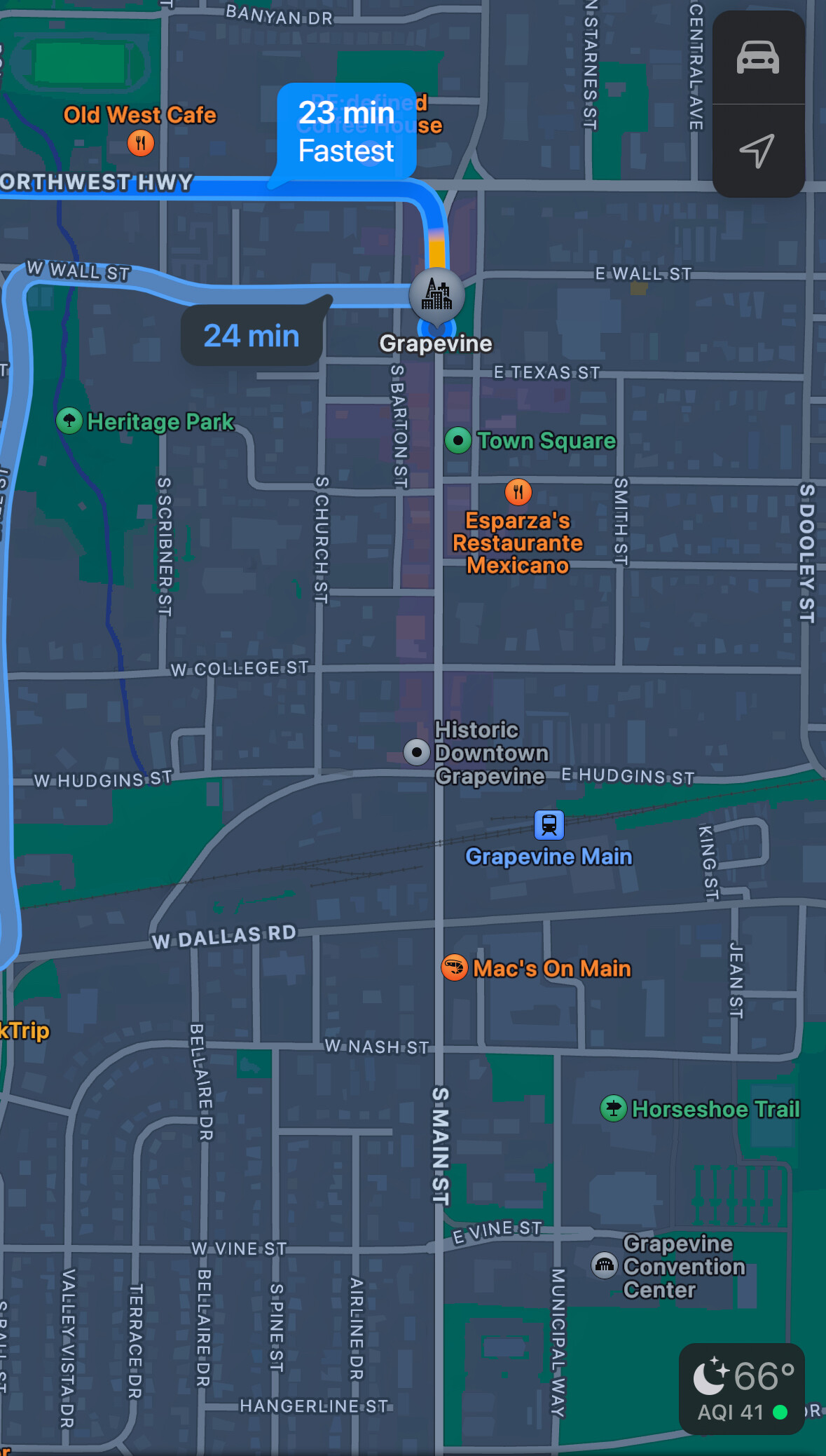
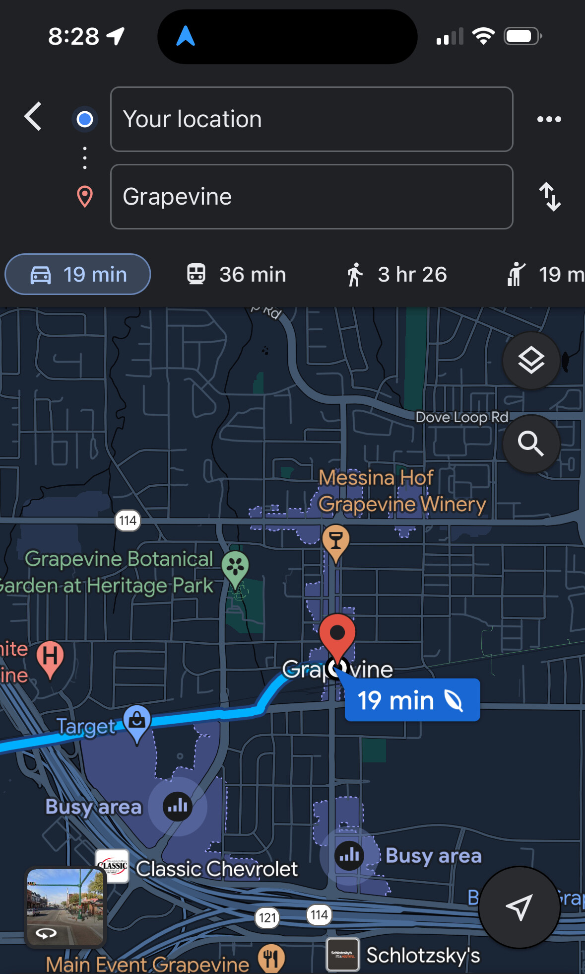
Having worked with Google Maps and Apple as well they have some city name issues as well at DFW Airport depending on the location you are looking for given that this isn’t a typical location. Each app has a different method of receiving feedback and responding to it for making adjustments.
We appreciate the feedback and always look into fixing map related issues with what we encounter and from the observations of the users. Sometimes the fix is more developer related and beyond what we can adjust.
If the Map editors can’t do anything about it- then who can? I have an email talking about this then it sent me telling me to do this… I this is a very reddit situation… How can I talk to someone to change it? Say someone who isn’t from my area- i will tell you right now that it takes a lot for someone understand DFW airport-- thank you for getting back to me!