Hi Editors,
I’d appreciate it if you could help me with a map update.
Permalink:https://waze.com/en-US/editor?env=usa&lat=44.16805&lon=-77.34949&zoomLevel=21&segments=539855280
Reason: Merging the Parking Lot to a level 3 road
Thank you
Hi Editors,
I’d appreciate it if you could help me with a map update.
Permalink:https://waze.com/en-US/editor?env=usa&lat=44.16805&lon=-77.34949&zoomLevel=21&segments=539855280
Reason: Merging the Parking Lot to a level 3 road
Thank you
I happen to have fixed the linked-to segment before checking if you had posted on the unlock forum. Sorry for that.
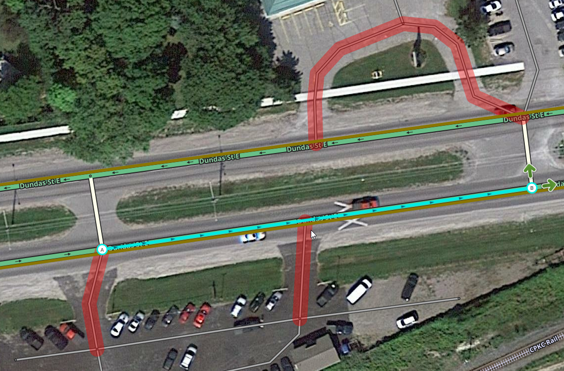
Further down the street I have downlocked the following segments that also need to be attached for you:
https://waze.com/en-GB/editor?env=usa&lat=44.16877&lon=-77.34368&zoomLevel=19&segments=60029946,536977917,60318210,60349241
Please let me know once those are fixed and I will re-lock them.
Yep, they are connected. You can lock the road.
Thanks!
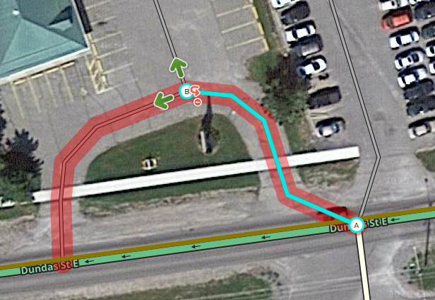
They may seem connected, but in fact they are not.
I have a script that highlights them red (WME Validator), but without it, you can tell by the fact that the segment of Dundas St does not have a junction node where the PLR segment “connects” with it:
Another way to tell is that where the PLRs do seem to connect to a node or segment, with the new PLR segment selected, there are no arrows allowing you to choose allowable turns:
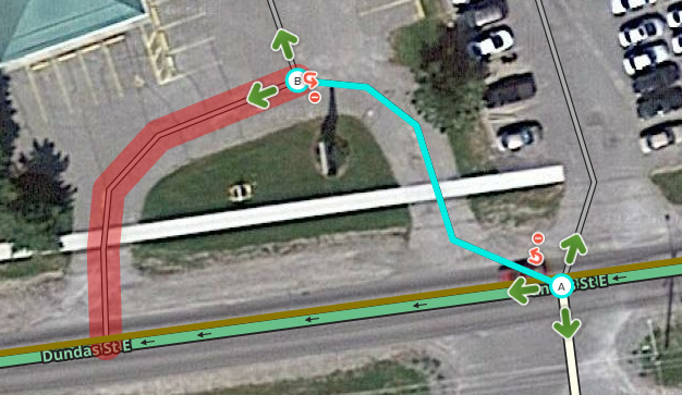
Here is an example of a correctly connected segment:
I undid any edits shown above to let you practice.
To correctly connect them, you will need to first select the segment you want to connect, drag the end you want to connect away from the node or segment you want to connect it to, let go of your mouse, then drag it back to the location where you want it to connect. It will otherwise remain with the “ghost connection”.
Let me know if there’s anything that’s unclear!
Once you’ve attached the PLRs, let me know and I’ll double check that everything is set correct and relock Dundas.
–DrO
I’ve attached the road segments as per previous reply. I think it should be good to lock now!
Thanks again!
Looks great! Relocked to L3.
Please mark this thread as solved to make sure that everyone’s aware this has been dealt with!
–DrO
Thanks @Dr_Obvious for helping.
The driveways here aren’t well aligned - despite that, is traffic intended to have the availability to make lefts to/from each commercial property?
https://waze.com/en-GB/editor?env=usa&lat=44.16877&lon=-77.34291&zoomLevel=20&segments=539855153,539623645
Along with that, I know Ontario allows u-turns, it is expected for a u-turn to be accepted here too? The other median segments on Dundas here are >15 metres so routing will serve a u-turn if needed, but this commercial driveway has been shifted to <= 15 metres meaning it will be prevented.
Hey Bryce,
Sorry for the delayed reply.
Is it better practice to align the driveways perpendicular to Dundas in this case even though they would create quite short segments between them? I had assumed that with these more compact junctions, it may be simpler to have everything joined at a single node rather than trying to deal with many short segments and the related turn restriction logic.
In terms of access to/from the individual parking lots, usually I would expect that you could get to the one further down the direction of travel, but not against the direction of travel on split roads like that. In this case, you could get to Water View Plaza parking lot from the Lions Centre parking lot, but not vice versa.
As for the u-turn, I would absolutely expect that someone could use the median connection to perform a u-turn or to turn into either of those parking lots.
Actually, in reviewing street view, the entrance to Water View Plaza is one way, so I’ve fixed this. I’ve also corrected the turn restrictions to better reflect what someone realistically and legally would do at that junction.
Thanks for looking into this and providing feedback! Let me know if there’s anything else I may have missed here.