Hi Editors,

I’d appreciate your help with a map update.
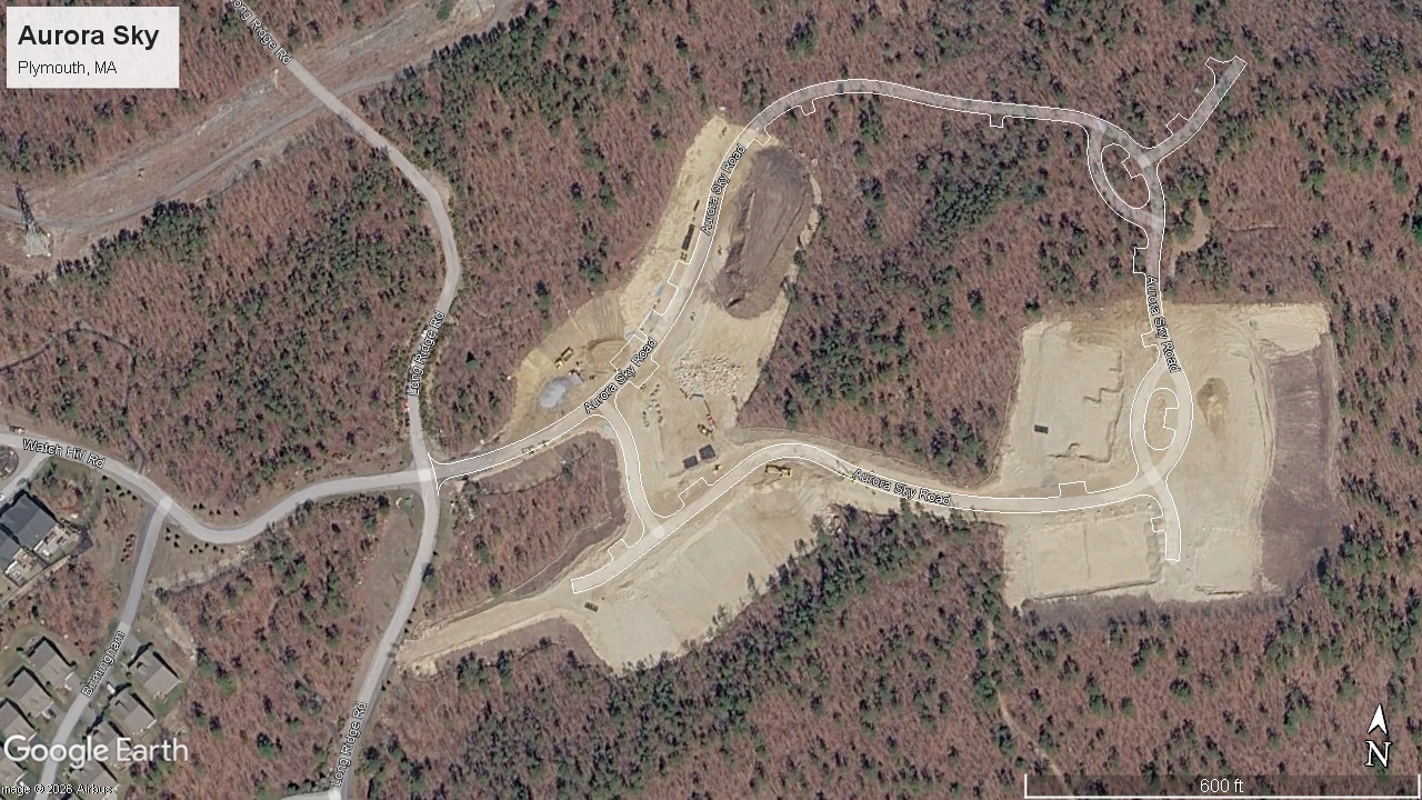
Permalink: https://waze.com/en-US/editor?env=usa&lat=41.91386&lon=-70.58721&marker=true&s=18852572597369194020862&zoomLevel=18&segments=539606278&majorTrafficEvents=-957240524
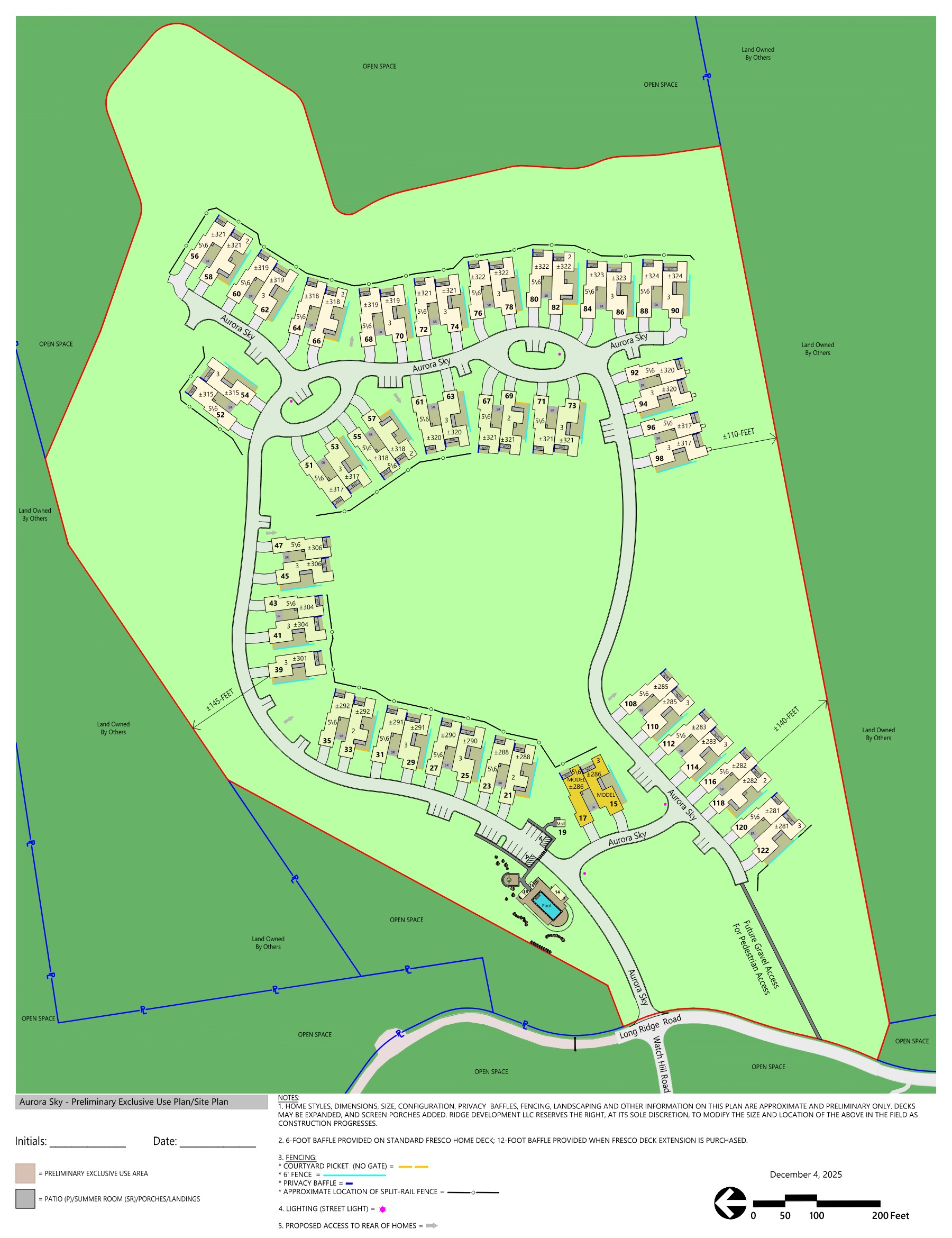
Reason: The name of the road is just Aurora Sky, not Aurora Sky Road, and the road is incomplete and inaccurate (the attached file displays the correct layout of Aurora Sky).
Thank you in advance,
1 Like
Thank you for this information. Unfortunately, we are prohibited from using Google Earth images as an information source for making updates to Waze’s map. Do you happening to have access to a developer’s (marketing) map for the community?
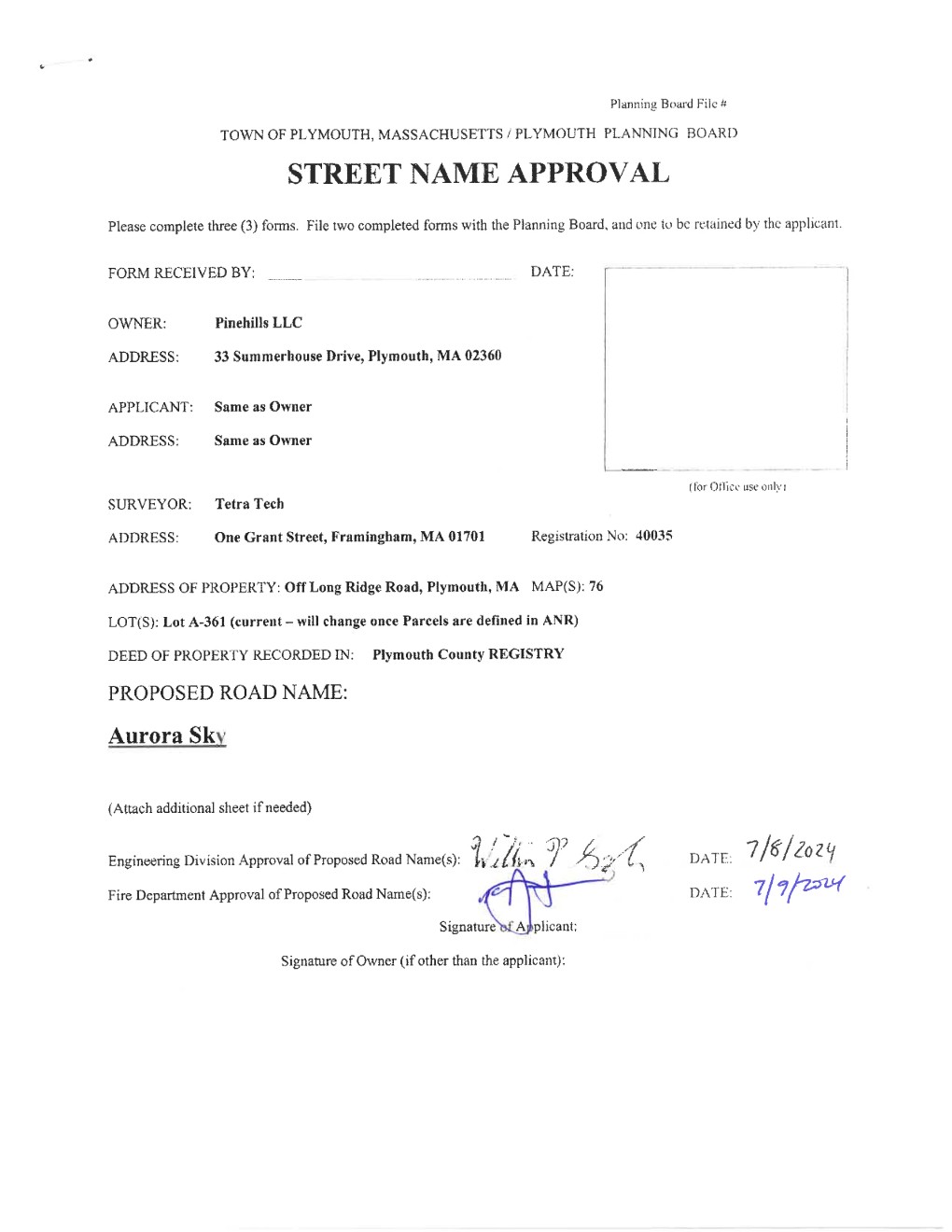
I have been able to verify that the Plymouth planning board approved the street name “Aurora Sky”, but until updated aerial images (that we are allowed to use, or GPS traces of actual traffic) are available, it will be difficult to update the roadway layout.
Thanks!
2 Likes
Thank you, Mudge42.
The attached files display the layout for Aurora Sky and the Street Name Approval Form the Plymouth fire and engineering departments signed.
Kevin
Perfect! That’s extremely helpful! I have added the remaining roads as well as the unit numbers to Waze’s map. Please allow 2-3 days for updates to take effect. Many Thanks!