Hi everyone, a MapRaid will be held to add missing traffic lights; the goal is to reach the 80% completion needed for this feature to be activated. It will be open to editors from level 3 and up and will last for 30 days (dates to be confirmed). It will specifically focus on the cities of Santiago, Concepción, Viña, and Valparaíso.
To participate, please sign up by May 1st, 2026, using the following form.
Hi everyone, the MapRaid begins today, May 4, 2026, and will run until May 24, 2026 (ultimately less than 30 days).
Please check if you have the cities of Santiago, Viña, Valparaíso, and Concepción available as editing areas; send me a message if you cannot edit those zones.
IMPORTANT: the editing is focused solely on adding traffic lights. Please do not make any other types of edits unless there are URs indicating a problem, in which case please report that a modification was made by including the permalink. Remember that editing rules or methods vary by country and can affect routing.
To help with “where the traffic lights are,” for now it is only feasible to use StreetView; we do not have a list of their locations.
Please confirm if you have editing permissions at least in Santiago; it seems the other zones haven’t been loaded yet. It’s already being looked into with Staff, but in the meantime, you can start in the entire Santiago area.
In this format, there won’t be teams or specific zones; you’ll have the chance to edit in the entire MapRaid area!! But please remember, only add traffic lights, do not perform any other types of edits (due to the different editing styles of each community). If you find something you think should be changed, improved, or removed, don’t hesitate to send a direct message or post right here to see how we resolve it, especially regarding at-grade connectors (AGC).
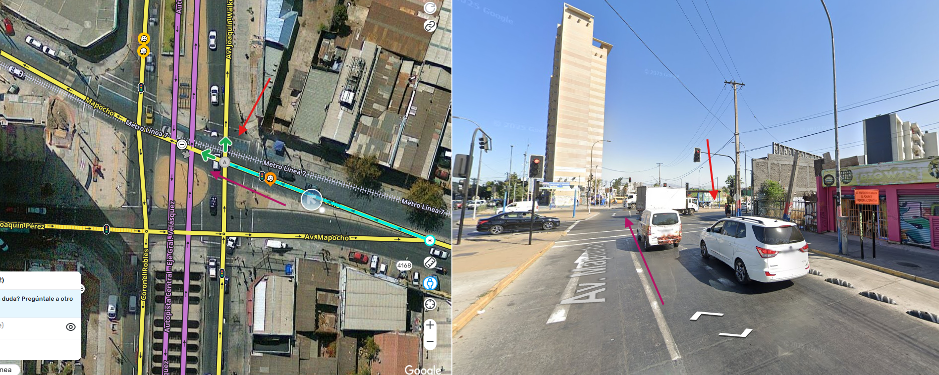
As seen in the image, when traveling along Av Mapocho, according to SV you cannot turn onto Av. Joaquín Walker Martínez. However, the segment currently has the turn allowed, and adding a traffic light enables the turn. (Please correct me if I’m wrong) If what I’m saying is correct, the turn should be prohibited on that segment.
I can only edit the areas of Santiago that I have traveled through. But for the rest of Santiago, it tells me I don’t have permission. I don’t have access to Concepción, Viña, and Valparaíso.
As a community, did you decide to map pedestrian signals?
How do you handle left turns at H or # type intersections? For that turn, should the instruction say “at the traffic light” or “after the traffic light”? Keep in mind that the turn is part of the intersection and that there are traffic lights at both the beginning and the end of the intersection, but only one is mapped (at the beginning) because vehicles don’t stop inside the intersection.