There is an odd routing decision in the vicinity of CFB Greenwood. Perhaps someone can shed some light onto what’s going on.
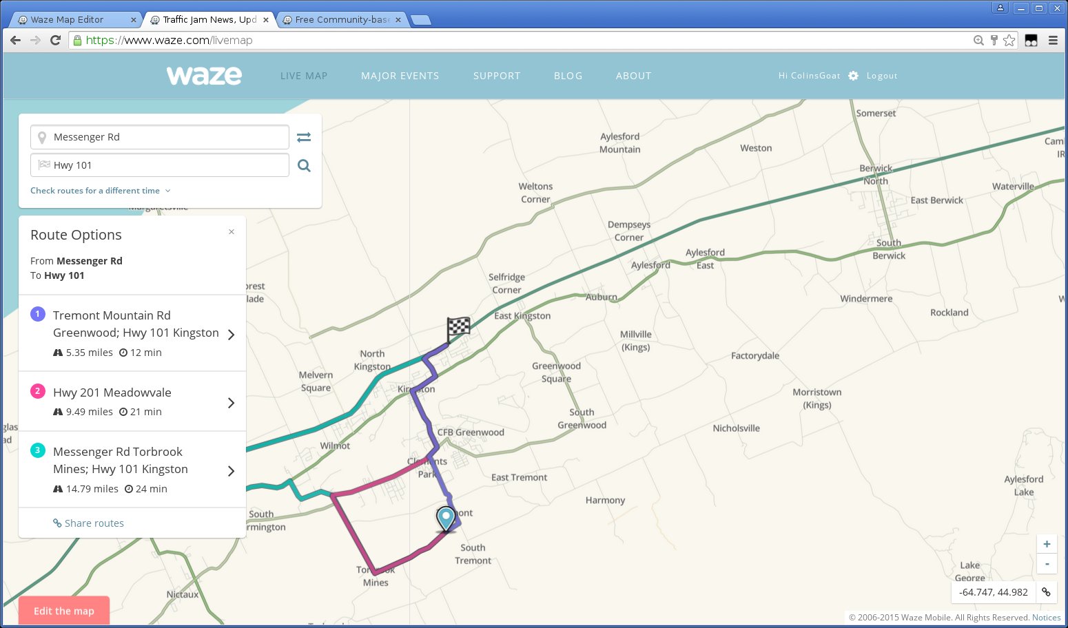
Starting in the Tremont region and heading onto Hwy 101, one would expect this route as optimal, that is, head from Hwy 1 up Maple St to the onramp:
If I move the destination just a little further along Hwy 101, everything is still fine:
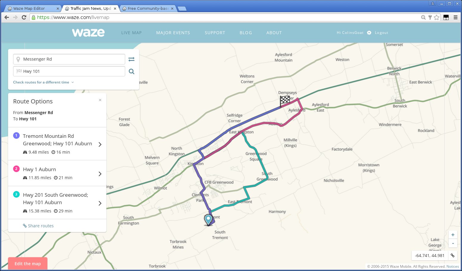
But moving the destination any further along Hwy 101, the calculated route ignores the obvious route along Maple St and suggests some pretty poor choices:
Any idea what is going on here? How can this be remedied? Would tagging Maple St as a “primary street” help?
The default route here is the correct one. Now try moving the destination eastward along Hwy 101. When you get to around Berwick, the default route becomes a poor choice; what should have been just an extension of the route from the first case disappears completely.
It might be a bug on the LiveMap display.
When testing on the Route Speed Script the route you described as the most logical one was the one suggested by Waze.
Did you experience this issue in realtime from the device?
In this case I suggest the following steps when this occur next time.
Log the exact day and time
submit your logs
report back here as quickly as possible including very detailed explanation of the problem with permalinks
What I would do then is report this to staff. The live logs are accessible for about 14 days, so it is important to send the request to them about the unusual route as fast as possible, as it take them time to get to these testings.
Regarding the script, I’m not an expert but go to the appropriate forum and ask for help. There should be people who could guide you there.
I’m not down that way very often, so perhaps this current report can be addressed quickly enough.
2015-10-03 23:38
Done.
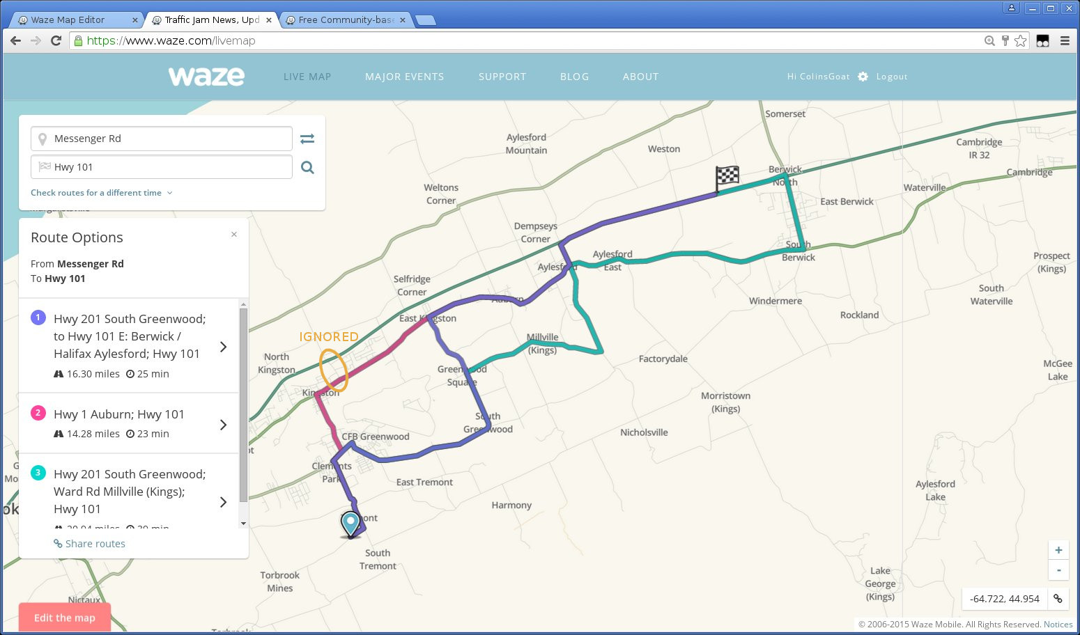
Non-optimal routing in the vicinity of CFB Greenwood / Berwick NS. Example permalink. The optimal route should begin as shown in purple on the following screen grab: Tremont Mountain Rd -> Central Ave -> Bridge St -> Hwy 1 -> Maple St -> Hwy 101
Logs should be submitted shortly after as in the time between this occurred and the time you submit your logs there might be some data loss from what was cached in your device.
So I decided to take matters into my own hands here and do a little experiment.
To recap, Waze was failing to find the optimal routing to Hwy 101, avoiding the obvious route up Maple St to the freeway onramp.
I recently recategorized Maple St and the nearby Bridge St from “street” to “primary street” (which they should be, anyway, IMHO, given their roles in the area) and bingo: the routing appears to work properly now, at least in the live map simulation.
So I guess the moral of the story is that the routing algorithm is only as good as the data it has to work with. With the aforementioned streets having been relegated to a status lower than they deserved, the routing algorithm avoided them, picking a route that scored higher, but was in reality less efficient.