Not sure how long this has been the case (probably months knowing me), but narrow streets are now highlighted as blue in the editor.
Meaning its easier to spot all the normal streets which have been changed by L1 editors with good intentions to narrow streets. Like here which causes this routing:
https://www.waze.com/livemap?lon=-0.97156&lat=51.32947&zoom=15&ll=51.32817448%2C-0.97048759&from=51.33007786%2C-0.95877171&at=now
A 0.5 mile drive turned into a 3 mile drive…
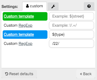
This change was made on 13th Jan, so less than a month ago, at least they no longer look like Private roads  . I still use a custom highlight in Validator to make these easier to spot and also lists them in the report when you scan the map with Validator.
This will continue to happen until HQ hide this Road type as requested by our Country Admins. The only alternative we have is to change the translation to “DO NOT USE” but this will only show if editors use the English (UK) MWE language.
I’m sure this has been discussed elsewhere, but as one of those (well meaning) L1 editors who added a narrow street (for a very good reason), how else do we classify a road so narrow and impassable that it has a 2T MAM, meaning about half of the cars and most vans on the road are forbidden? Is it a function that would have to be performed by a higher level editor? As I have encountered a lane which Waze shows a great love for, a shortcut into Highley, which was so narrow I almost got stuck.
This is the road in question - every time I visited Highley I was routed (understandably as it is NSL) into this downright dangerous gorge road.
The issue is the terminology “narrow street”. My understanding is it should be used for alleyways or passageways where a motorbike could drive, but a “normal” car can’t drive. The road that you linked to is a perfectly driveable road for most vehicles. Not for a lorry, but Waze has no setting to differentiate between vehicle types.
For anyone who hasn’t read all the threads on the subject, ie. most people, its tempting to change a single track country road into a Narrow Street, because it is …a narrow street.
I guarantee the first thing I would have done when I started editing would have been to change small back roads into narrow streets (as well as intricately mapping individual car park lanes and footpaths which we’ve all done…)
Actually there is an argument for changing this road to a private road…a sign at one end says “access to Borle Mill only”. But there is no sign at the other end.
I like the sound of that. I would guess the reason they put those signs up was to prevent people trying to take that exact shortcut. The signs are only just Worboys era so it’s likely the restriction - and the road - well predate the nasty tendency of any route planning system which doesn’t know road widths -other than a rough idea - to favour a road which is NSL.
Speaking of which, as I live in an area where the main roads are often bypassed by country lanes which are NSL but do not permit NSL driving along most of their length due to conditions, I wish there was some chance of WME implementing a country lane setting which would give unfavourable routing to those tracks. However the more detail you go into with that implementation (for example using Narrow Streets to represent narrow lanes) the more possible problem scenarios arise, so I can see why it hasn’t been done.
From what I understand Waze doesn’t use the speed limit set on a segment when calculating a route, that parameter is only for speed alerts in the app. Waze stores real time speed for each segment and uses that historic data when calculating a route, so twisty NSL country lanes will generally have a lower recorded speed than the adjacent main road.
That’s good news. Doesn’t entirely solve the problem as some of the lanes aren’t just winding, they have tight bends and no or tiny passing places. The locals take their lives in their hands at 40, 50, 60mph round these bends which resulted in several hair-raising near misses and a gentle collision (no fault, really it was a road design issue with the passing place being too narrow. Reversed my wing mirror into a hedge trunk…) when I started driving vans, put me off any single track work for a long time. I’m getting into it now but I still won’t touch any of the roads between the A48 and M4 apart from for access, but when the roads clog up towards Cardiff, Waze has a strong preference for the more risky lanes which nobody is using, hence the high historic speeds. Technical solutions to this sort of thing are difficult.