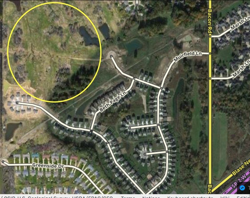
Hi, my apologies. First time here. I am wanting to add new streets and addresses to this new sub-division in Painesville, Ohio. I cannot edit the map and am wondering how I go about either communicating that information to someone who can or receiving permission to do that work independently. Any help would be appreciated. I have place an image of the area as an attachment. Thank you.
If you create a Waze login, and login to that account on your phone, and then drive in that area using Waze, your account will get editing permissions for that area. There are restrictions on new level 1 editors, but I think you can create new roads.
Painesville is out of my editing area, so I cant directly help there.
The link for that area in the map editor (WME) is here:
https://waze.com/en-US/editor?env=usa&lat=41.75700&lon=-81.21318&zoomLevel=18
Dave
And us as a community can guide you through the process of adding this yourself, please let us know what you want to do. I see we have County GIS information on the street names and house numbers, so we can add all that information to the map for sure.
Just for clarification…it depends on how new the account is. A brand new account cannot edit segments, even with editable area. It must be used for a time (not sure if it’s based on time or driven miles, or both)