Segment ID is 517634732. I have tried to make edits but as a Level 1 editor I don’t think I have proper permissions. The town installed a gate a few year ago to prevent traffic from driving past the new public safety building. Waze is still routing cars through the neighborhood even though the gate blocks access, see attached picture looking south-west from Palisades St towards fire station. If you look closely in the Waze satellite photo you can see the shadow of the date. Please advise. @W1QA fyi.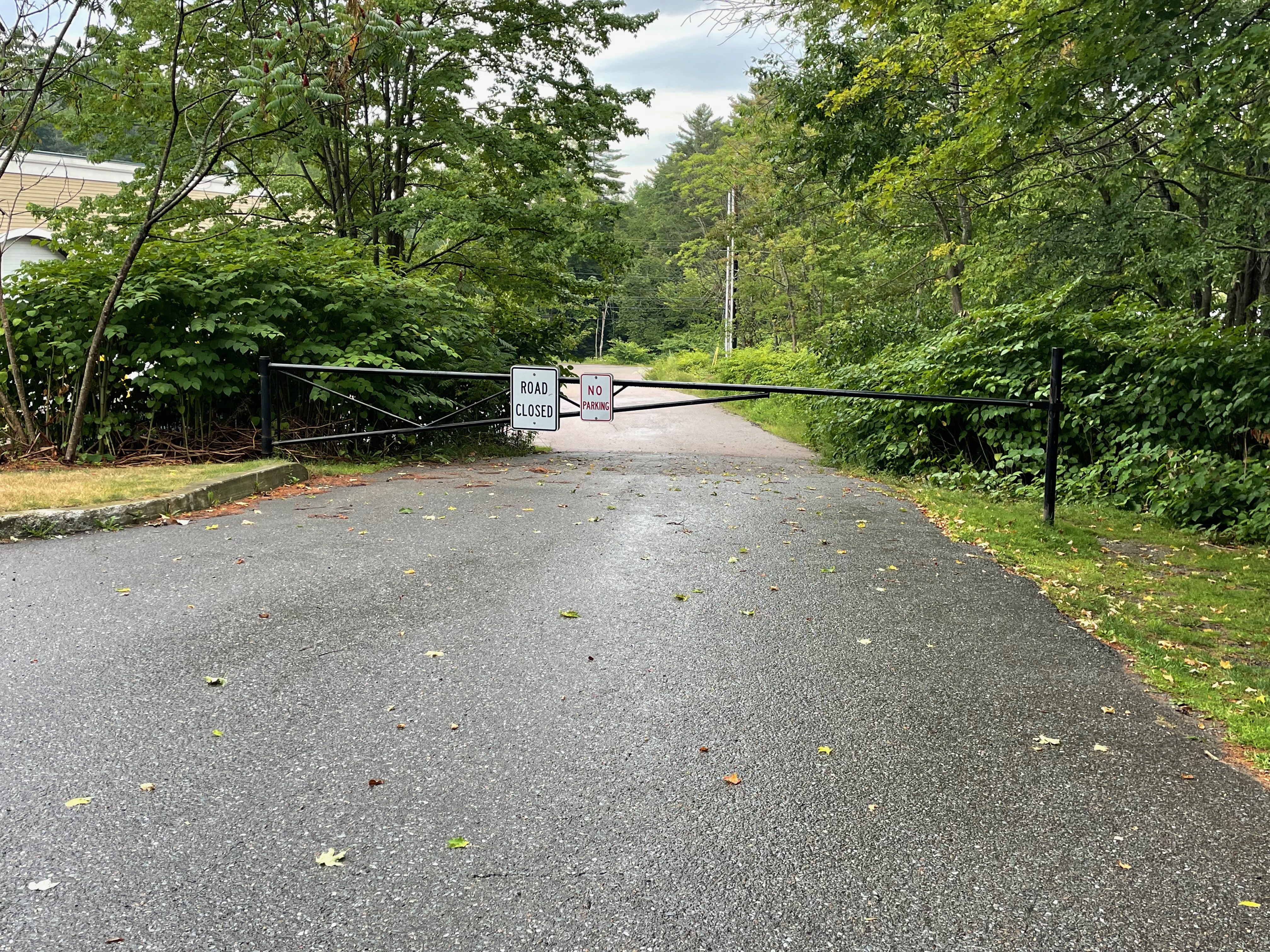
Thanks John for your feedback. This is pretty interesting!
Good to disconnect Palisades back to where the gate is and indeed I can see that in the aerial view.
Here’s where it gets interesting though. Palisades St and Ln are class 9 roads - private, not maintained by the town. In using the VT E911 viewer:
https://maps.vermont.gov/e911/Html5Viewer/?viewer=e911viewer
it shows that there is a Palisades Ln that is just west of S Main St and perpendicular to Palisades St. There are two houses on the Lane and the house numbers follow a format that would be for the lane, and not the street.
Street View (in an Oct 2018 photo) shows the sign on the corner of S Main St as PALISADES ST PVT (next to the chiropractic office). Do you know if that sign is still there today, or is there one now for Palisades Ln? If the town made changes here I’d guess they have not updated the state (yet).
I think I will reach out to the Town of Stowe and see what they say.
Additionally - the other end of Palisades (that now wraps around the back of the police and fire departments) we may just want to make either a (Waze) private road or a parking lot road. We generally only have named streets that follow the VT E911 street naming. (Both the police and fire departments have S Main St addresses.) Who knows - maybe the town has created a different name for the road that goes up beside the police station.

Thanks Bob. I can confirm a few things:
- Yes the Palisades St PVT sign is still in place, see attached
- I’d keep the two houses on ‘Palisades Ln’ ‘as is’. There’s no sign there but a resident on there confirms that is the common name to which its commonly referred.
- There’s no sign whatsoever down by the police station. I was walking around researching the situation and ran in to Stowe Police Chief Don Hull who indicated the road by the DPW/Protective Services “didn’t have a name”.
Separate question: Will these Waze updates eventually propagate to Google Maps, or is that a separate editing process?
Thanks for your support. 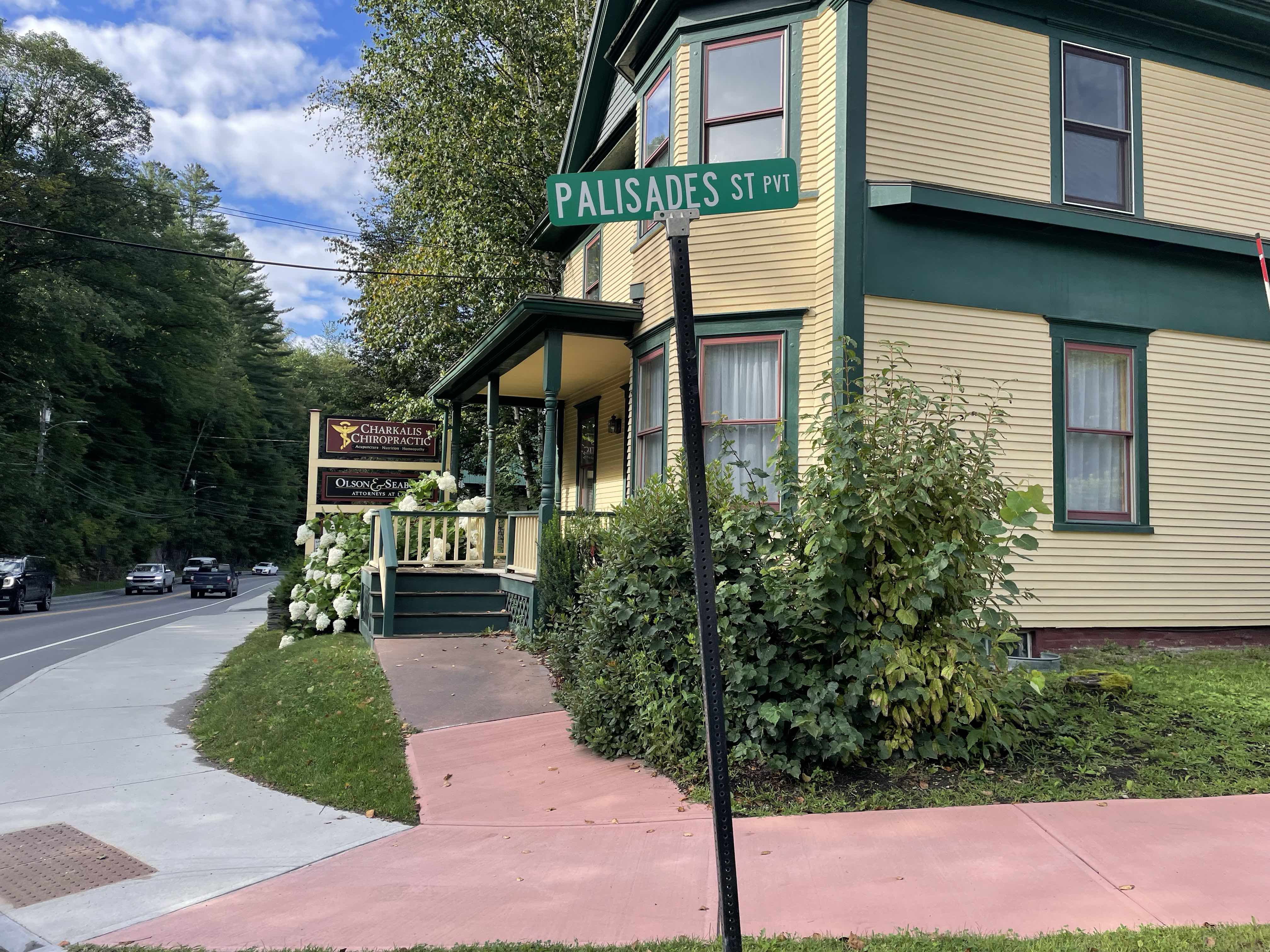
Hi … thanks for the Boots on the Ground (BOTG) support!
No - Google Maps doe snot inherit changes from Waze, or vice versa. (There are a few things where there IS interface between the two maps, and that includes closures we enter usually show up in GM as well.)
I will attempt to make the changes in Google Maps. Sometimes they will accept them and we’ll have it published in a few days, and sometimes it is a fight to get things changed and may take a while. There is a Waze editor’s channel in the USA Discord server with a number of Google Maps trusted editors and we can get their help if one of us editing locally in VT can’t get the changes pushed through. I’ll keep you updated!
Hi @W1QA, noting the updates on Google Maps are also in effect, so many thanks I think we can ‘declare victory’ on this concern!
Hi … yea, I’m actually shocked! I did get an email yesterday (or sorry, maybe the day before) noting that the submitted change had been accepted. This kind of thing doesn’t often get done on the first pass, so I’m thankful that in fact it has made it to Google Maps. Appreciate your help in providing the local updates - take care!