[REQUEST] switchable WME satellite imagery source

Hi all

I live in the area with aggresive development, previously Waze using source from Bing but recenlty switched to Google and this is a problem since Google haven’t update from 6 years back.

I haven’t finish adding and fixing tons of road and landmark and now I find it difficult to add/fix them without current sat img guidelines,
please, please make an option to switch from multi satellite imagery source.

chek out this screenshot WME compared to Bing satellite images:
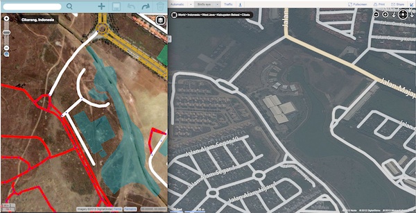
googlevsbingsmalljpg.jpg

Unfortunately, we can no longer use Bing aerials. This is a an unsurprising consequence of Waze being bought out by Google.

Worldwide there are winners and losers - in some places Google is more up to date than Bing. I’m afraid it looks like your area is a loser. :frowning:

Please note that use of aerials other than those provided in the editor is not allowed.

You win some, you lose some…
In some area’s the photo’s are better, in some area’s it’s worse.