Hi, I have been routed to Castle street in Oxford, UK. I got a fine for using a bus route although I can’t see a sign on google maps. I have no way to verify it so please exclude it from route suggestions. Thanks.
I’m just looking at Castle Street now. There doesn’t seem to be any restrictions on Castle Street itself, but there are when turning off onto Norfolk Street:
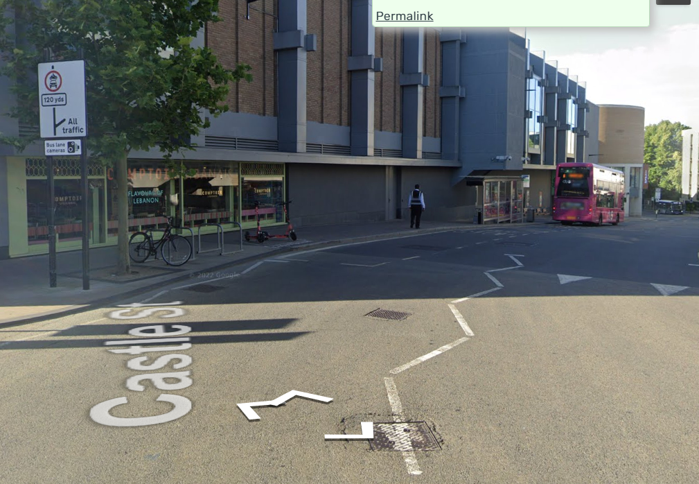
Can you confirm where exactly you got caught? Are these new restrictions not on Google Street View (latest imagery Sept 2024)?
Ok, so I’ve checked Oxford Council’s website and they have the following plan for the bus gate/lane:
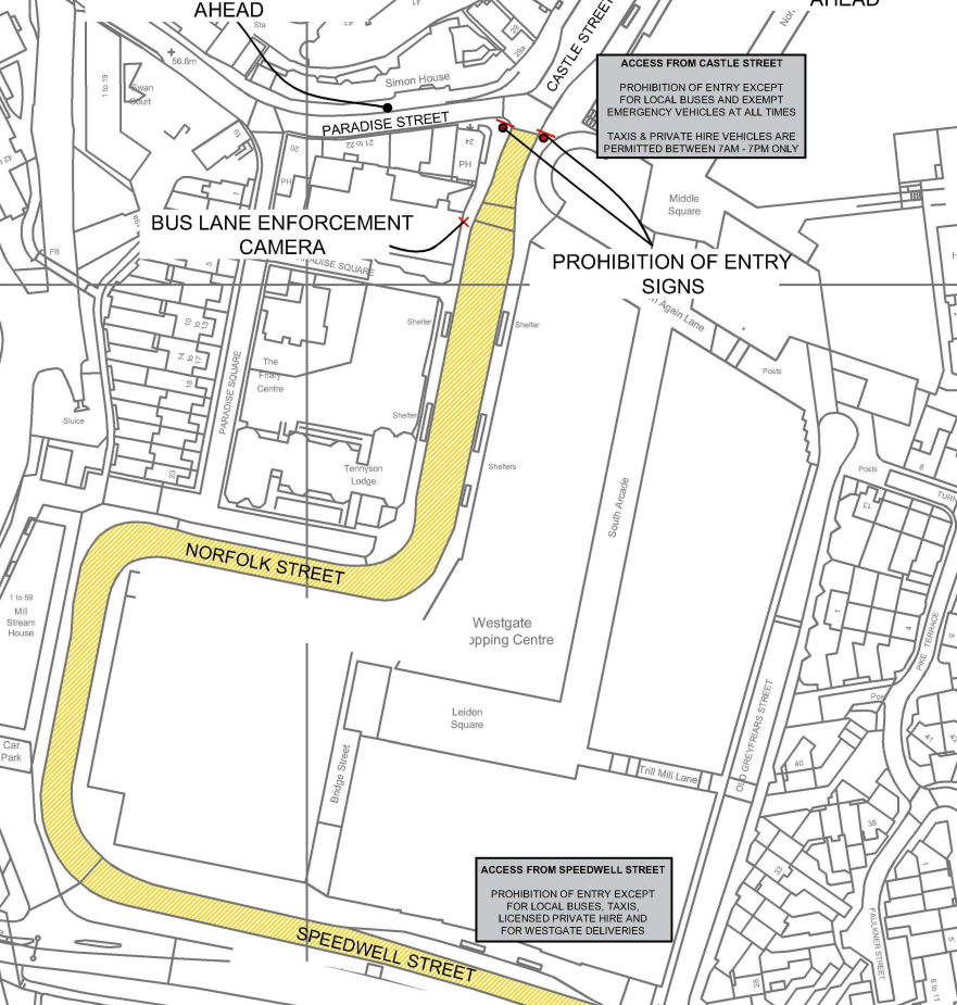
This is already restricted to buses (24hours) and taxis (7am-7pm).
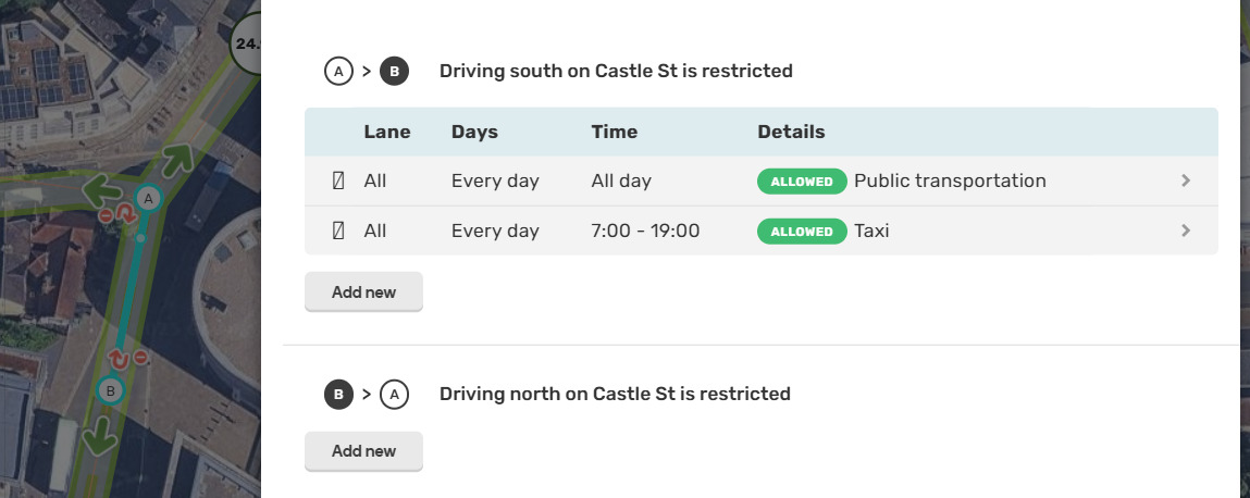
Can you check the vehicle settings you have on your Waze app? If they’re set to Taxi (or were at the time), that will be why you were routed that way.
Thanks for looking into this. I checked the video that council shared. I drove in to castle street from New road. Tgere is a sign at the end of tge castle street entering to New road but not other way round.
My waze app is set for my car , i use it almost everyday for my commute so I never needed to change it to a taxi. I could share a photo but struggling to upload it from my phone
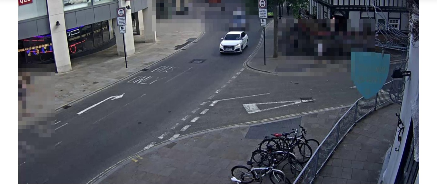
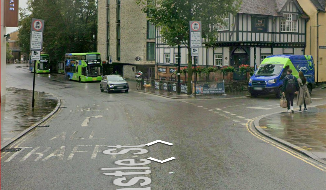
Thanks for your reply. Is that you coming towards the camera? If it is, then you’re heading towards New Road, coming out of Norfolk Street.
Can you confirm your original and the destination? I’m trying to get a sense of why Waze would have put you on that road (other than user error ![]() )
)
I still find it strange how Waze could have directed you that way, as all of Norfolk Street and Speedwell Street are restricted on the map to buses/taxis.
Good morning,
Sorry for the late response. I was driving towards the camera. I went to google maps to check the road I was coming from and I didn’t see any signs or road markings. You could see the road sign on the video facing away from me.
Thanks very much.
Regards
Roy