Hi all
I can’t work out what is going on here

Hi all
I can’t work out what is going on here
Who deleted the 3 streets is probably more the question. Missing streets restored and junction at Maioro & Richardson Rd corrected.
I suspect its something to do with the new motorway
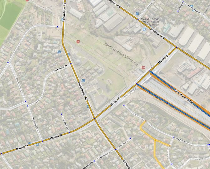
Seems strange that it’s SW of the SH20 where the motorway currently finishes. When I was up that way 8 months ago, the new extention carried on in a NW direction.
I’ve photoshopped a gmaps image over the aerial Waze picture to show the proposed motorway. Bing maps show the same thing.
Updated: June 20 by SteveC100(1)
I believe SteveC100 is the user who made the changes?
Lvl 1 user… could explain it. best to ask him then.
Hi,
I havent reported any map error at that location? Might it have been because of the large diversion in the road that it raised an error?