Hi,
I am in Kent, there is a road just by my house that is closed until the 24th October 2025 and waze is totally unaware. I wanted to mark the closer myself as no one else has, but I am only level one on the map editor and need to be level 4. I cannot find any information about how I can level up, and I have no idea why this closure has not been imported from the one.network map.
Is anyone able to mark the closure for me, or advise how I can level up to do it myself?
Hi Faye, to level up, you need to work with the UK to edit the map, and it’s not a quick process.
Only some closures from around the country are imported automatically, as it depends on the reliability of data given to one.network by the local authority (Kent Council in this regard).
Can you give me the location/road name and the town where the closure is?
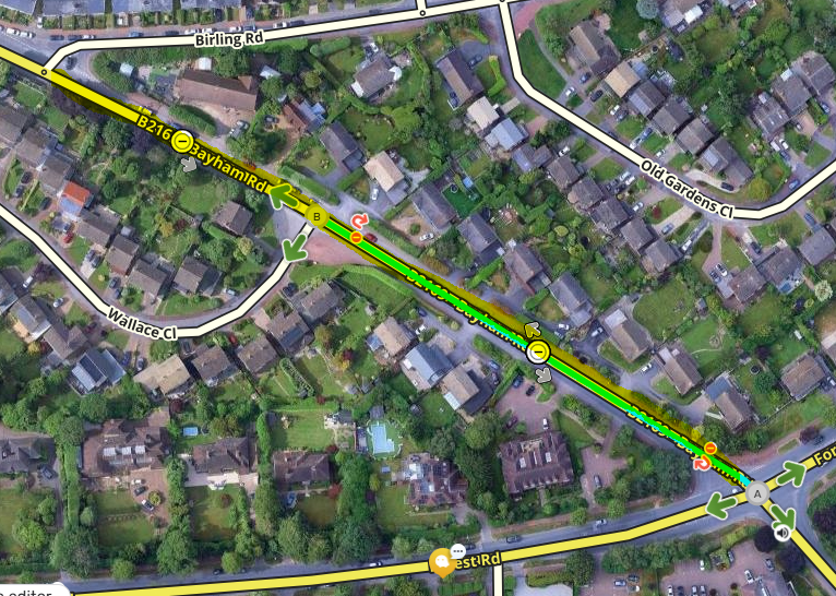
Hi, thanks for your response. The road is Bayham Road in Tunbridge Wells. It is fully closed between Forest Road and Birling Road and will be until the 24th October. I have tried to attach an image and link to one network,
Birling Road is not closed.
Thanks, Faye
Thanks for the response. The road is now closed.
Thanks so much  Super helpful and I know myself and others will be grateful for the improved navigation around the closure and traffic lights!
1 Like