Good morning,
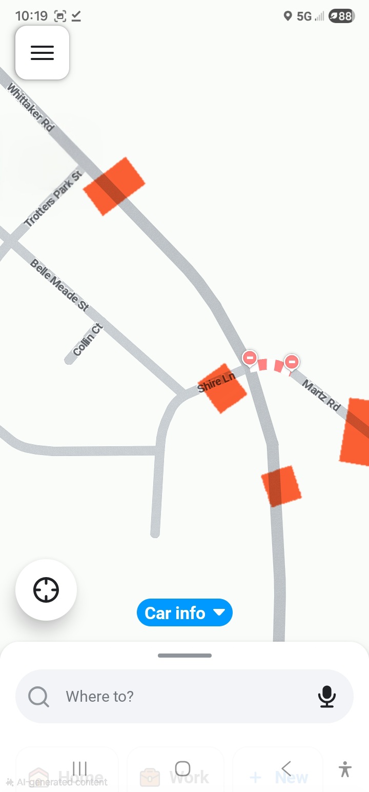
I tried to take care of this on the app and was chatting with JB15TM on the WAZE APP, but then he closed the conversation before I could respond to his last comment. I’ve attached a screenshot of he map of the area as it appears in the app now (incorrectly). His last comment was JB15TM “The closure is correct. Only the intersection is closed for both routes. But Whittaker is open on both sides of the intersection for local access.”
This is absolutely NOT the case. They are installing a roundabout at this intersection. So there is NO local access through or around this intersection. Whittaker Road is closed (completely torn up both North and South Bound lanes) about 15 yards South of Trotters Park all the way through the intersection and approximate 40 yards South of Shire. Shire itself is completely torn up and impassable from the intersection, 10 yards West of the intersection. Finally, Martz is completely torn up, both East and West Bound from the intersection to about 50 yards east along Martz.
There is NO local access through this intersection, and there won’t be for 10 to 12 weeks. The way Waze is currently showing it on the attached map, it appears to drivers that they can cut through that neighborhood and pick up southbound Whittaker because the map is showing only a small section of Martz closed. This is NOT the case.
1 Like
Editor JB15TM has the intersection closed in Waze. While it doesn’t show in the App, routing thru that intersection is currently prohibited. Waze will not currently offer the route to anyone using Waze to navigate to a destination. It appears he entered the roundabout closure in this manner so that Waze can continue to route correctly for the homes on Shire. He has also trimmed the segments of Whittaker in Waze so that a closure can be added to the portion of Whittaker within 200’ of the construction, which I have just entered.
Jeff
1 Like
Hi Jeff,
I see the updates in the app now. The only thing missing is the section of Shire, west of the intersection which is also torn up for about 15-20 yards, too. Basically, about halfway to the Belle Meade intersection.
Regards,
1 Like
I assume the residents on that segment of Shire Ln are allowed to go home? Not closing Shire will allow them to get routes too. The full closure of the other segments will prevent Waze from attempting to route thru traffic here, there’s no need to add Shire Ln to the closure.
Jeff
1 Like
Actually there are three homes impacted. One on the north side, two on the southside. They have limited access to their driveways, but can only access them through the neighborhood. The road is torn up in front of those homes. Until the project is over you cannot use Shire at the intersection of Martz and Whittaker in ANY direction.
I understand that, and Waze will not use that intersection because there are no valid exits from it. I can still allow the homes on Shire Ln to route to their homes and prohibit thru traffic with the way the closures are currently set up. Waze will not route anyone over that segment other than those with a destination on that segment even when it doesn’t have a visible closure on it. The way this was set up by JB effectively did the same thing as he had the intersection marked as closed on the back end. That closure doesn’t show in the app, but does effectively close the intersection for thru routes. I only added the closures on Whittaker to make it more obvious in the app that the intersection is closed to people that aren’t using Waze for routing at the time.
Jeff
Got it. Thanks for the assist