With permission from SkiDooGuy, this script is now available from WazeDev. The GreasyFork link below has been updated. (jm6087)
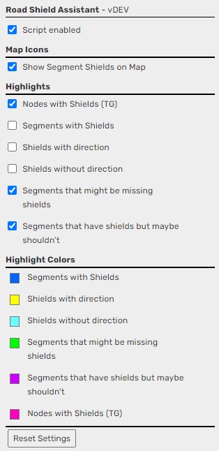
Road Shield Assistant is designed to assist editors mapping shields. There are several general options as well as some that need to be configured per country.
If the country specific options are not configured for your country the relevant options will be disabled in the UI. Please DM/PM myself (SkiDooGuy) and we’ll work to get your country set up for those options.
This script is also translation ready - so if it’s not loading in your localized language please let me know and we’ll get the strings loaded.
I also say thanks @SkiDooGuy for this much-needed addition when mapping Road Shields.
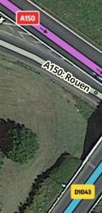
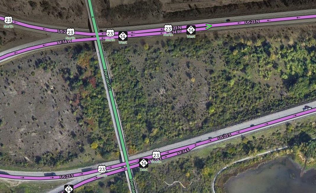
I noticed that Road Shields on ramp segments are not being displayed. This is needed in Germany because of the import done by Waze, such ramp segments also have a Road Shield set.
If we could see them with the script more easily, we could better remove them in the future.
Can you please only highlight if the route number being shielded is the only thing on the segment? With the addition of the ramp highlighting, almost every single ramp segment now glows. Everything from a simple “to I-90 W” to more complex names are highlighted. Also, roads that are “Old US-42” were already being highlighted and shouldn’t be. Thank you!
ETA: Clearly, if there is a directional on the route name, that should stay. Eg, “90 W” should be highlighted, but “to 90 W” or “Exit 5: 90 W » Cleveland” should not be highlighted.
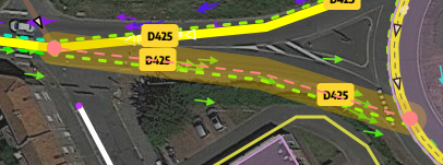
The highlights on Maryland state routes (MD-xxx) always show “Segments that have shields but maybe shouldn’t”, even though they should have shields. Eg, MD-10 and MD-100 here.
Being as the checks are based on Regex, there may be errors as I coded the US all at once and quickly. So please let me know if there are incorrect results and I’ll update them.
To those who are awaiting updates from me to include your country please stay patient. I’ve had a busy couple weeks with little time to devote to programming.
RSA seems to have some “black hole” areas in which it won’t display any shields. When panning into or within a black hole, I get the following error in the console:
Error thrown in: tryScan
 TypeError: Cannot convert undefined or null to object
newHandler @ WazeWrapLib.js?_=1620262615897:1637
triggerEvent @ third_party-6653a26a14e59922ae36.js:1
moveTo @ third_party-6653a26a14e59922ae36.js:1
pan @ third_party-6653a26a14e59922ae36.js:1
e.panRight @ app-ad02689de58442a04e8d.js:1
T @ third_party-6653a26a14e59922ae36.js:1
f @ third_party-6653a26a14e59922ae36.js:1
c @ third_party-6653a26a14e59922ae36.js:1
u.trigger @ third_party-6653a26a14e59922ae36.js:1
e.trigger @ app-ad02689de58442a04e8d.js:1
e.triggerEvent @ app-ad02689de58442a04e8d.js:1
value @ app-ad02689de58442a04e8d.js:1
In particular, most of the District of Columbia and some of the nearby areas around the borders of the District seem to be a black hole.
Is it an issue that this script is displaying Road Shields in Production WME? Or can we safely assume that the only editors that will have installed it are beta editors?
 (“D6015”)