The statement in the wiki only prohibits copyrighted sources, any information listed in the public domain with no copyright or loyalties including no requirement for attribution should be allowed to be used.
Sent from Android using Tapatalk
The statement in the wiki only prohibits copyrighted sources, any information listed in the public domain with no copyright or loyalties including no requirement for attribution should be allowed to be used.
Sent from Android using Tapatalk
Open Source is copyrighted, with a liberal use license.
I’ve been getting this weird behavior where random text seems to disappear from the page. Is anyone else experiencing this? After toggling scripts on/off, I’ve narrowed it down to Toolbox. With just Toolbox and no other userscripts or extensions running, I get the following:
It is reproducible. When I turn off Toolbox, everything returns to normal. Turning Toolbox back on, the text disappears again. However, there is a randomness aspect to it as well. If I select/deselect some more segments, eventually the text may come back. Also, if I fiddle with the visibility/opacity of a single text field, all text fields will return to normal.
I’m running Chrome Version 48.0.2564.116 (64-bit) on Mac OS 10.10.5 using the latest Toolbox in the Chrome store.
Thanks for taking a look!
I remember others reporting the fields being black somewhere last week. I guess it’s this. However, I have yet to see this on Chrome.
Sent from my Galaxy Tab A using Tapatalk
I have the same random thing happening to me… Did not know why… I’m also running chrome but on Windows 10… Thanks John (JD)
Sent from my XT1080 using Tapatalk
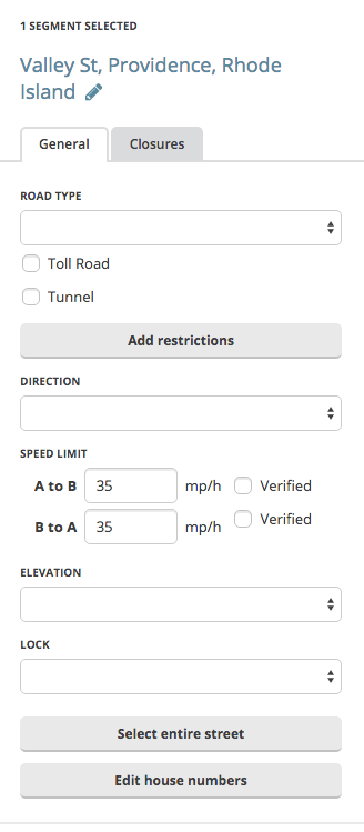
Feature request: with speed limit highlighting turned on, can we have some way to distinguish “unverified” from “verified” speed limits? Maybe a dashed line, or something along those lines (pardon the pun)?
It’s really not that simple. It depends on the license terms. OpenStreetMap’s license states something to the effect of “you can’t use this information for your commercial purposes.” If the resource that Glodenox is using states that it is free to use for commercial purposes with no attribution, then its license is different than OSM’s, and it may be used without trouble.
In regards to the Speed Limit layer I was wondering if it were possible to have colors which are not so much alike?
The colors look nice as they are in this post but its not very easy to see when the limit actually changes in the editor if it goes from i.e. 20 to 30.
About the people still discussing about the maps in the script I’m working on:
So let’s stick to WME Toolbox-related things in here ![]()
Gents,
This post got lost in an “off-topic” discussion. But the editors from the Netherlands and Belgium would love to have this implemented in Toolbox.
Not even sure if this was logged as a feature request or issue at all.
Could the devs look into this?
Thanks!
Arno
Not going to happen and please do not do this.
Due to copyright issues, we are expressly prohibited from using 3rd party maps and data sources other than those provided within WME.
The entire country of Chile was reverted back to basemap because it was discovered that SOME data from OpenStreets had been copied into the Waze map.
Fully aware, this government data was already approved and IS in use and this is going OFF TOPIC, again. ![]()
The question is to slightly modify TB layer setup. Nothing else.
send from my SGS4, using Tapatalk
??? What the hell are you talking about?
If you have a problem with me take it to PM
I’m lost. How was that an off topic reply?
And the “again” comment?
This is the tb thread. Not a copyright discussion.
Verstuurd vanaf mijn SHIELD Tablet K1 met Tapatalk
Not "again"to you personally, but to the copyright discussion. As was the main reaction on glodenox first post on page 55.
The actual question was unfortunately never answered.
Verstuurd vanaf mijn SHIELD Tablet K1 met Tapatalk
Page 55. This is page 62/63. You mean to tell me that in order to reply to a thread, one must have read every single page and know what was said?
I’m referring to that post. So if you or taco you read my post carefully you could have taken a look because I’m referring to that and the same thing is happening now.
And btw most people including you 2 are here quite often ;), if I’m not mistaking.
This time, again, the question is disappeared from the last page due to a nonsense discussion. I like the devs to look at the possibility.
(Copyright is a separate issue and glodenox’ script can be discussed in his thread.
(This data was used by waze to import house numbers for example…))
send from my SGS4, using Tapatalk