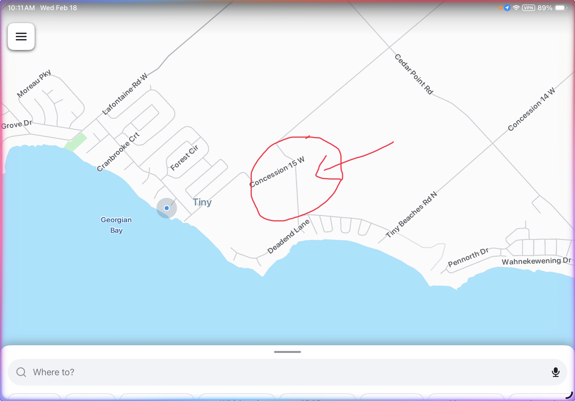
In Tiny Township, Ontario, there is a seasonal road closure annually during winter that is not reflected on the map. It needs to be updated by someone. I have attached a screen shot with the closed section of the road shown on the map with a red circle. I also attach a link to the official notice from the township. This section of the 15th Concession is closed annually from November 30th to April 30th.
Hi there,
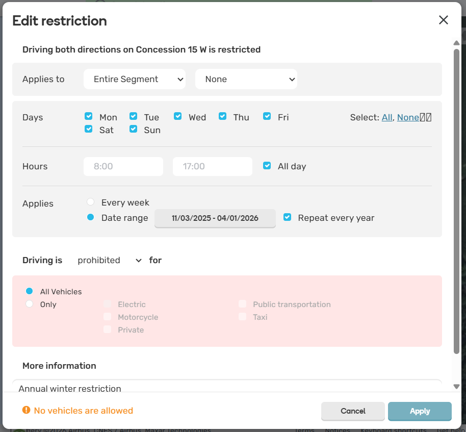
We do have it in place but not as a road closure, we have it as a restriction.
So while there is no visual representation in app that the road is closed, you should not get a route through it from November to April 1 every year. Looking at the notice, I will update the start and end times of the closure.
The area in the screen cap you sent looks different on my end. Just to confirm, you’re referring to this segment, right?
Yes. That is the segment. Thanks
Before noticing Psst’s response, I entered the closure on this segment until April 1. We decided to leave the closure in-place to make it more visible, even though there is a yearly restriction in-place preventing routing from happening on that segment during the winter.
Yes that makes sense to show it even if routing avoids it. Thank you