https://www.waze.com/editor?env=row&lon=1.23120&lat=52.67364&s=70360341&zoom=8&segments=122374235
Bus-stop layby (where the white car is in the satellite image), on the Drayton-bound side of the road, a new access road is being built for a new estate. 29th July to 1st October.
https://roadworks.org/?113968420
Hi there, thanks for taking the time to post this, however we do not change anything on the map due to temporary traffic lights. Waze should notice the change based on how long it takes to travel along this road and adjust routes if the delay is sufficient.
If only. It doesn’t seem to pick it up from Elgin sometimes, so it’s not directing me past. There’s two major sets of roadworks on this road and Waze keeps telling me everything’s golden, but I know if I use it I’ll get stuck in traffic for 10 minutes. Twice.
Waze will route you through slow traffic if it thinks alternate routes are not quicker. The ELGIN alert have no influence on routing, they are a visual thing only.
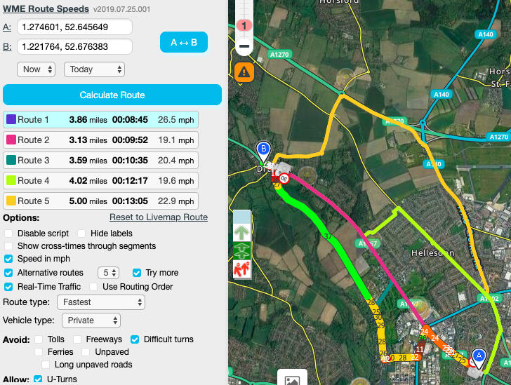
Looking at the current routing, and this only an example at a particular time, your own route will be planned based on time, length of journey, etc.
Based on typical average speeds Waze routes from A to B along Drayton High Road.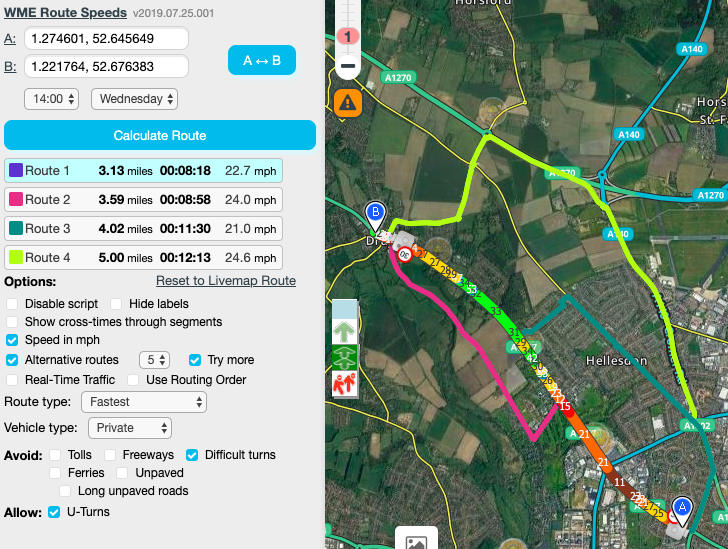
Based on real-time traffic speeds, hopefully due to the roadworks, Waze is diverting around.
Routing in the opposite direction Waze routes along Drayton High Road for typical and real-time data. We can’t add anything to influence the routing other than add a full road closure.