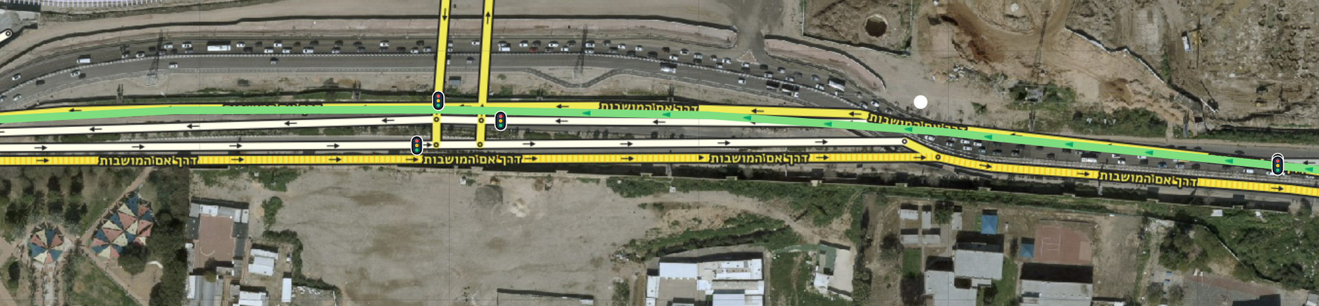
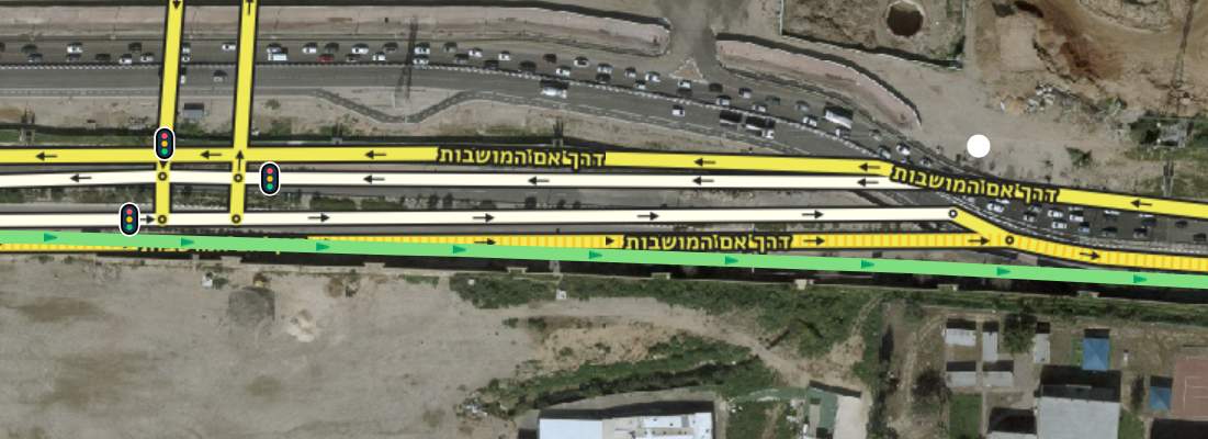
Here the incorrect geometry is causing a wrong arrow shape (an arrow that looks like a “keep right” when it is actually a “keep left”) on the map (meaning, the arrow on the road on the map—not in the instruction).
I am requesting an unlock to fix it.
Junction B here, I’ve marked all the segments that need to be removed (to avoid overlaps). The whole road is straighter — this bend doesn’t exist in reality at all (as can also be seen in the GPS tracks).
Is there anything complex about the junction/area that requires special care?
Until recently, there were quite a few changes and lane shifts there, so the GPS data seen in WME doesn’t accurately reflect reality. At the junction you marked, you mentioned earlier that there’s a lane guidance display issue. I didn’t see an explanation. It’s very important that “Keep” (Right/Left) instructions are provided there depending on the selected route, as this impacts the rest of the path. Additionally, there are several reports currently under review, and it’s best not to make unnecessary changes until they’ve been checked (depending on cooperation from the reporters). If you have information regarding the lanes there, it would be good to update it.
The road’s shape (shifted north) doesn’t reflect reality based on my personal impression in the field; the GPS points actually align with what I saw (even if there is a slight deviation between GPS points and reality, it’s still closer than the current mapping).
The issue at the junction isn’t with the lanes, but rather that the shape of the arrow shown on the map doesn’t match reality and the instruction. I was alert because I thought there might be a mistaken “Keep Left” constraint by mistake when it was supposed to be “Keep Right,” so I didn’t notice the lanes.
This UR here might actually support my point; perhaps he missed the “Keep Left” instructions because he was looking at the map instead of the prompt… it’s possible this is the reason for the other reports as well.
It seems the same geometry issue exists here, although to a lesser extent (perhaps the deviation isn’t even visible in the client).
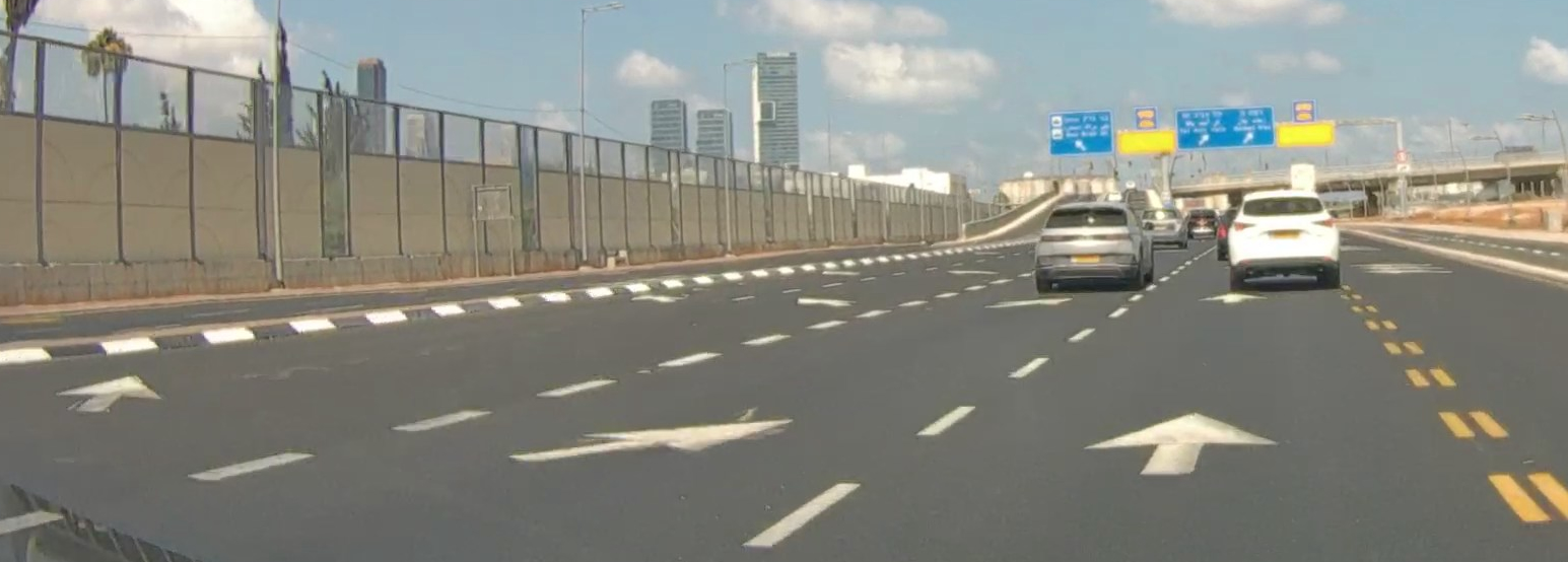
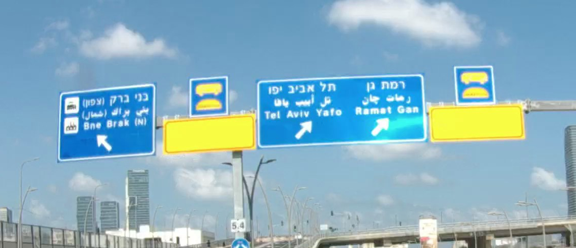
The road does indeed need to be shifted slightly south in some parts (only in the junction area). But the display and instructions should remain with “Keep Right” (for those who will drive under the bridge) and “Keep Left” (for those who will go up the bridge). According to the following image, the road markings might be confusing. In any case, you can see the correct direction on the overhead signage.
As long as the reporter hasn’t had their say, it’s impossible to guess what exactly bothered them. The answers, in many cases, are surprising. By the way, it’s preferable for drivers to concentrate and look at the road. The instruction is voiced at the correct location (as long as the driver is listening and/or not preoccupied with other things).
Until now, I didn’t have lane information, so they weren’t marked. Now they can be updated. Including the instructions:
 .
.