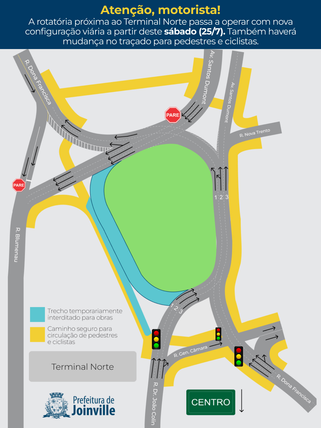
Good evening, everyone. This weekend (07/25), a new large roundabout connecting several streets in the northern region of Joinville will partially open. This change is part of the Santos Dumont Avenue widening project, which is expected to be completed by the end of the year.
The official announcement, including a map of the new roundabout layout, was posted on the city hall website:
I could change the map myself, but since it’s a major change involving a complex intersection, I thought it best to post it here and ask for help from more experienced editors, especially since one of the sections will be closed for a period.
If needed, I can make the changes and someone can check to see if everything is correct. I live near this location and pass through there every day, so my local knowledge might be useful.
Thanks in advance, and I’m available if you need more information.
Since you know the location, it’s better if you update it yourself. I can help you with that this afternoon if needed. Or, if someone from the area can do it, even better.
If anything comes up, just message me in the chat. I’m available.
Perfect, Mauricio. Thank you for your help. My question is whether I should set it as a roundabout or an unnamed street. The city is calling it a roundabout, but it will have an oval configuration, with streets entering and exiting tangentially (image below). I believe it’s best to leave it as an unnamed street so it doesn’t generate “at the roundabout, take the Xth exit” instructions. Suggestions?
By the way, I’m unable to edit because these two segments are locked due to lane guidance. This lane guidance will actually no longer be valid, so it can be deleted. If anyone could unlock them, I’d really appreciate it.
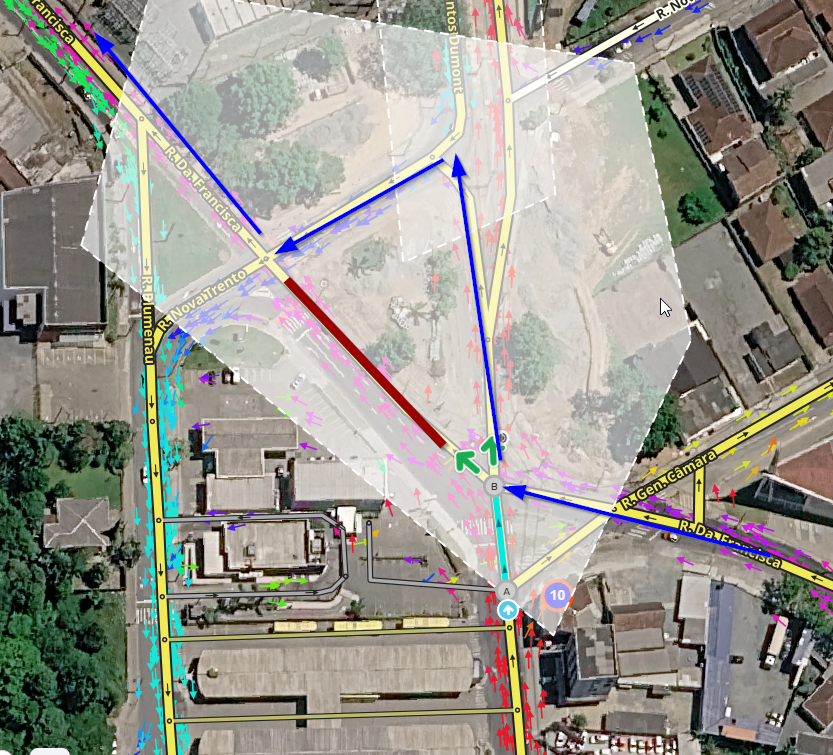
My suggestion for this location, since there are no updated images of the completed work, would be to just delete/close the segment highlighted in red;
The layout of the new roundabout seems very similar to what already exists; the main change seems to be the number of lanes and that those coming from D. Francisca St now have to follow Santos Dumont Ave before turning back (Blue arrows)
I would leave the layout practically the same and wait for new satellite images.
That makes sense. It’s a good temporary solution, already for the opening. Over the weekend I’ll head over there and go through the new route a few times with the GPS recording it, and I’ll fix whatever is needed.
Anyway, I can’t do anything with that section that will be closed, not even correct the traffic direction, because it’s blocked by the lane guidance at the end of João Colin Street. I’d appreciate it if you could remove that lane guidance for me, please.
Thank you very much, MauricioCGB. Lalo-cross had already made almost all the changes there, but today I passed by there taking some images and recording the new layout with my GPS, so I took the opportunity to get it just right.
Now, if someone could set up the new lane guidance (I don’t have access), I’d appreciate it. These are the official instructions from the city hall:
Those traveling on Rua Dona Francisca toward Eixo Industrial or Rua Blumenau should enter the roundabout ramp and use lanes 1 and 2. Drivers wishing to continue toward Avenida Santos Dumont should stay in lanes 2 and 3 of the roundabout.
Drivers on Rua Dr. João Colin heading for Rua Dona Francisca should use the roundabout ramp and stay in lanes 1 and 2 until the desired exit. To continue toward Avenida Santos Dumont, drivers should use lanes 2 and 3.
Drivers traveling on Avenida Santos Dumont wishing to head toward Rua Blumenau can use any of the three traffic lanes, helping distribute the vehicle flow within the roundabout. Meanwhile, those wishing to access Rua Dona Francisca should use lane 3 of the roundabout.
Thank you very much, once again, for everyone’s attention.