Press here to return to the Cities and towns section to see your changes
The Commonwealth of Massachusetts is divided into 351 Cities and Towns. When assigning the “City” property to Road Segments please use this list. Do not deviate from this list without approval from State Mgmt.
City/Town map as PDF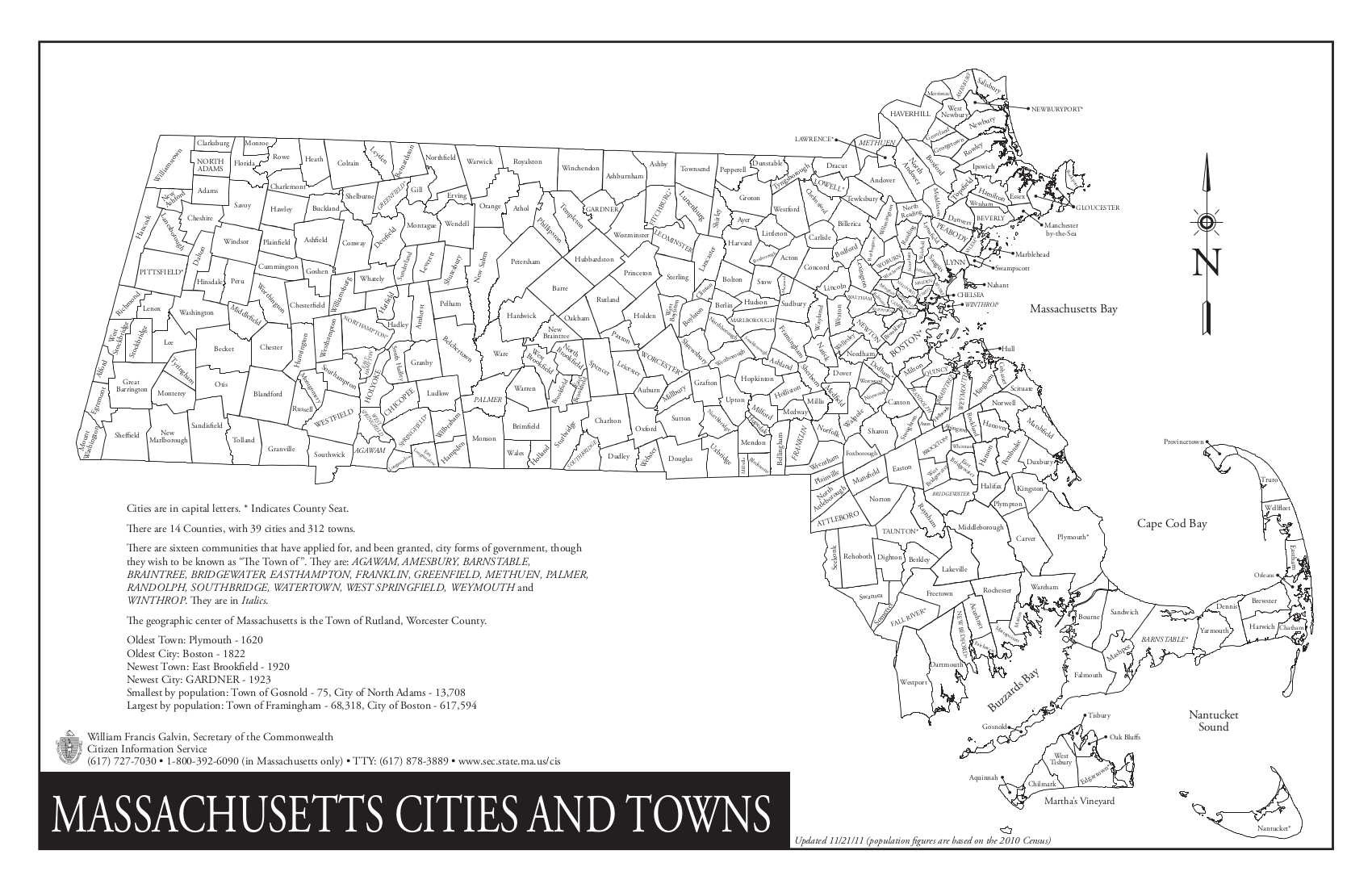
A B C D E F G H I J K L M N O P Q R S T U V W X Y Z
A
- Abington (GIS)
- Acton (GIS)
- Acushnet (GIS)
- Adams (GIS)
- Agawam (GIS)
- Alford (GIS)
- Amesbury (Plat)
- Amherst (GIS)
- Andover (GIS)
- Aquinnah (GIS) - (formerly Gay Head)
- Arlington (GIS | Zoning.pdf)
- Ashburnham (GIS)
- Ashby (GIS)
- Ashfield (GIS)
- Ashland (GIS | Plat)
- Athol (GIS)
- Attleboro (GIS)
- Auburn (GIS)
- Avon (GIS)
- Ayer (GIS)
B
- Barnstable (GIS)
- Barre (GIS)
- Becket (GIS)
- Bedford (GIS | Plat)
- Belchertown (GIS)
- Bellingham (GIS)
- Belmont (GIS | Street Map)
- Berkley (GIS)
- Berlin (GIS)
- Bernardston (GIS)
- Beverly (GIS)
- Billerica (GIS)
- Blackstone (GIS)
- Blandford (GIS)
- Bolton (GIS | Plat)
- Boston (GIS | Alt GIS)
- Bourne (GIS | Plat 2015)
- Boxborough (GIS)
- Boxford (GIS & Plat)
- Boylston (GIS)
- Braintree (GIS)
- Brewster (GIS)
- Bridgewater (Plat)
- Brimfield (GIS)
- Brockton (GIS | MuniMapper)
- Brookfield (GIS)
- Brookline (GIS | Plat)
- Buckland (GIS)
- Burlington (GIS)
C
- Cambridge (GIS - Select “Parcel”)
- Canton (GIS)
- Carlisle (State GIS)
- Carver (GIS)
- Charlemont (GIS)
- Charlton (GIS)
- Chatham (GIS | Plat-like)
- Chelmsford (GIS)
- Chelsea (GIS)
- Cheshire (GIS)
- Chester (GIS)
- Chesterfield (GIS)
- Chicopee (GIS)
- Chilmark (GIS)
- Clarksburg (GIS)
- Clinton (GIS)
- Cohasset (GIS)
- Colrain (GIS)
- Concord (GIS)
- Conway (GIS)
- Cummington (GIS)
D
- Dalton (GIS)
- Danvers (GIS)
- Dartmouth (GIS)
- Dedham (GIS)
- Deerfield (GIS)
- Dennis (GIS)
- Dighton (GIS)
- Douglas (GIS)
- Dover (GIS)
- Dracut (GIS | Plat)
- Dudley (GIS)
- Dunstable (GIS)
- Duxbury (GIS)
E
- East Bridgewater (GIS)
- East Brookfield (GIS)
- East Longmeadow (GIS)
- Eastham (GIS)
- Easthampton (GIS)
- Easton (GIS)
- Edgartown (GIS | Plat)
- Egremont (GIS)
- Erving (GIS)
- Essex (GIS)
- Everett (GIS)
F
- Fairhaven (GIS)
- Fall River (GIS)
- Falmouth (GIS | Plat)
- Fitchburg (GIS)
- Florida (GIS)
- Foxborough (GIS)
- Framingham (GIS)
- Franklin (GIS)
- Freetown (GIS)
G
- Gardner (GIS)
- Gay Head (see Aquinnah)
- Georgetown (GIS)
- Gill (GIS)
- Gloucester (GIS | PLAT)
- Goshen (GIS)
- Gosnold (GIS)
- Grafton (GIS)
- Granby (GIS)
- Granville (GIS)
- Great Barrington (GIS)
- Greenfield (GIS)
- Groton (GIS)
- Groveland (GIS)
H
- Hadley (GIS)
- Halifax (GIS)
- Hamilton (GIS)
- Hampden (GIS)
- Hancock (GIS)
- Hanover (GIS)
- Hanson (GIS)
- Hardwick (GIS)
- Harvard (GIS)
- Harwich (GIS | Plat)
- Hatfield (GIS)
- Haverhill (GIS)
- Hawley (GIS)
- Heath (GIS)
- Hingham (GIS)
- Hinsdale (GIS)
- Holbrook (GIS)
- Holden (GIS)
- Holland (GIS)
- Holliston (GIS)
- Holyoke (GIS)
- Hopedale (GIS)
- Hopkinton (GIS)
- Hubbardston (GIS)
- Hudson (GIS)
- Hull (GIS)
- Huntington (GIS)
I
- Ipswich (GIS)
K
- Kingston (GIS)
L
- Lakeville (GIS)
- Lancaster (GIS)
- Lanesborough (GIS)
- Lawrence (GIS)
- Lee (GIS)
- Leicester (GIS)
- Lenox (GIS)
- Leominster (GIS)
- Leverett (GIS)
- Lexington (GIS)
- Leyden (GIS)
- Lincoln (GIS)
- Littleton (GIS)
- Longmeadow (GIS)
- Lowell (GIS)
- Ludlow (GIS)
- Lunenburg (GIS)
- Lynn (GIS)
- Lynnfield (GIS)
M
- Malden (GIS)
- Manchester-by-the-Sea (GIS)
- Mansfield (GIS)
- Marblehead (GIS)
- Marion (GIS)
- Marlborough (GIS)
- Marshfield (Plot|GIS)
- Mashpee (GIS)
- Mattapoisett (GIS)
- Maynard (GIS)
- Medfield (GIS)
- Medford (GIS)
- Medway (GIS | Plat)
- Melrose (GIS)
- Mendon (GIS)
- Merrimac (GIS | Plat)
- Methuen (GIS)
- Middleborough (GIS)
- Middlefield (GIS)
- Middleton (GIS | Plat)
- Milford (GIS)
- Millbury (GIS)
- Millis (GIS | Plat)
- Millville (GIS)
- Milton (GIS)
- Monroe (GIS)
- Monson (GIS)
- Montague (GIS)
- Monterey (GIS)
- Montgomery (GIS)
- Mount Washington (GIS)
N
- Nahant (GIS)
- Nantucket (GIS)
- Natick (GIS)
- Needham (GIS)
- New Ashford (GIS)
- New Bedford (GIS)
- New Braintree (GIS)
- New Marlborough (GIS)
- New Salem (GIS)
- Newbury (GIS)
- Newburyport (GIS)
- Newton (GIS)
- Norfolk (GIS)
- North Adams (GIS)
- North Andover (GIS)
- North Attleborough (GIS)
- North Brookfield (GIS)
- North Reading (GIS)
- Northampton (GIS)
- Northborough (GIS)
- Northbridge (GIS)
- Northfield (GIS)
- Norton (GIS)
- Norwell (GIS)
- Norwood (GIS)
O
P
- Palmer (GIS)
- Paxton (GIS)
- Peabody (GIS)
- Pelham (GIS)
- Pembroke (GIS)
- Pepperell (GIS)
- Peru (GIS)
- Petersham (GIS)
- Phillipston (GIS)
- Pittsfield (GIS)
- Plainfield (GIS)
- Plainville (GIS)
- Plymouth (GIS)
- Plympton (GIS)
- Princeton (GIS)
- Provincetown (GIS)
Q
- Quincy (GIS)
R
- Randolph (GIS)
- Raynham (GIS)
- Reading (GIS)
- Rehoboth (GIS)
- Revere (GIS)
- Richmond (GIS)
- Rochester (GIS)
- Rockland (GIS)
- Rockport (GIS)
- Rowe (GIS)
- Rowley (GIS)
- Royalston (GIS)
- Russell (GIS)
- Rutland (GIS)
S
- Salem (GIS)
- Salisbury (GIS)
- Sandisfield (GIS)
- Sandwich (GIS - Plat)
- Saugus (GIS)
- Savoy (GIS)
- Scituate (GIS)
- Seekonk (GIS)
- Sharon (GIS)
- Sheffield (GIS)
- Shelburne (GIS)
- Sherborn (GIS)
- Shirley (GIS)
- Shrewsbury (GIS)
- Shutesbury (GIS)
- Somerset (GIS)
- Somerville (GIS)
- South Hadley (GIS)
- Southampton (GIS
- Southborough (GIS)
- Southbridge (GIS)
- Southwick (GIS)
- Spencer (GIS)
- Springfield (GIS)
- Sterling (GIS)
- Stockbridge (GIS)
- Stoneham (GIS)
- Stoughton (GIS)
- Stow (GIS)
- Sturbridge (GIS)
- Sudbury (GIS)
- Sunderland (GIS)
- Sutton (GIS)
- Swampscott (GIS)
- Swansea (GIS)
T
- Taunton (GIS)
- Templeton (GIS)
- Tewksbury (GIS)
- Tisbury (GIS)
- Tolland (GIS)
- Topsfield (GIS)
- Townsend (GIS)
- Truro (GIS)
- Tyngsborough (GIS)
- Tyringham (GIS)
U
W
- Wakefield (GIS)
- Wales (GIS)
- Walpole (GIS)
- Waltham (GIS)
- Ware (GIS)
- Wareham (GIS)
- Warren (GIS)
- Warwick (GIS)
- Washington (GIS)
- Watertown (GIS)
- Wayland (GIS)
- Webster (GIS)
- Wellesley (GIS)
- Wellfleet (GIS)
- Wendell (GIS)
- Wenham (GIS)
- West Boylston (GIS)
- West Bridgewater (GIS)
- West Brookfield (GIS)
- West Newbury (GIS)
- West Springfield (GIS)
- West Stockbridge (GIS)
- West Tisbury (GIS)
- Westborough (GIS)
- Westfield (GIS)
- Westford (GIS)
- Westhampton (GIS)
- Westminster (GIS)
- Weston (GIS)
- Westport (GIS)
- Westwood (GIS)
- Weymouth (GIS)
- Whately (GIS)
- Whitman (GIS)
- Wilbraham (GIS)
- Williamsburg (GIS)
- Williamstown (GIS)
- Wilmington (GIS)
- Winchendon (GIS)
- Winchester (GIS)
- Windsor (GIS)
- Winthrop (GIS)
- Woburn (GIS)
- Worcester (GIS)
- Worthington (GIS)
- Wrentham (GIS)
Y
- Yarmouth (GIS)
Source: Mass.gov: Massachusetts city and town websites