such a shame all these regressions for L3’s permissions in France those times
Hi
I can’t draw a place inside a roundabout without having an error message when saving: geometry is wrong
Both in Prod and Beta
Hello, I have a suggestion for a new feature… It’s simple but I think it fits perfectly in Toolbox:
A button to highlight segments with “Average Speed Camera” check.
It is very difficult to actually see which segments have this feature turned on. And if someone turns it on by accident, it’s almost impossible to detect it, except if you drive through it.
Hello! Love, Love Love this script.
Suggestion/request - add a checkbox/color to identify toll roads for editors. Currently only way to tell (I believe) is to open segment and check restrictions. But, if they are locked above your level, gets pretty labor intensive to go through unlock/lock process just to see ‘if’ segment is designated as toll rd. Engaged in this activity due to an UR…
If this isn’t added to TB you can find it in WME Color Highlights
Thanks Ojlaw!
using color highlight will give you dash on the street that has toll attribute on it
As Phil22140 (from France) said before,
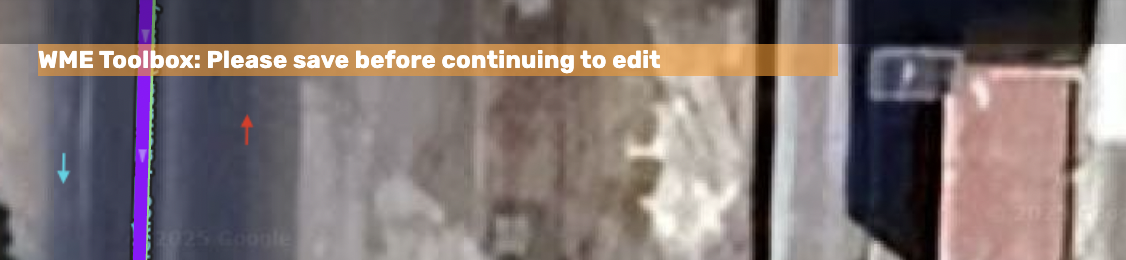
the “Draw roundabout area place” now works but cannot be recorded
recording generates an error message
Drawing works
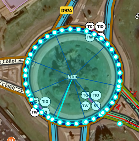
Recording fails

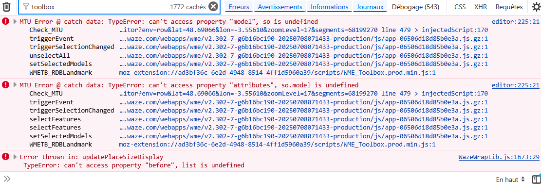
Errors (filter with “Toolbox”)
1 Like
Thanks @majorjc_MS !
That was the problem.
Thanks,
1 Like
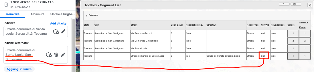
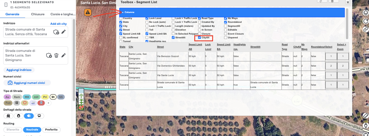
Hello,
Why does the Alternative City appear as null in the Segment List?
Is this a mistake? Or is this a feature not supported?
Thank you, @AndyLaode !
Hi @imlama - how did you get that segment view from toolbox? I do not see that option in Toolbox.
I have the same issue of getting an error message stating “The highlighted place has an invalid shape”
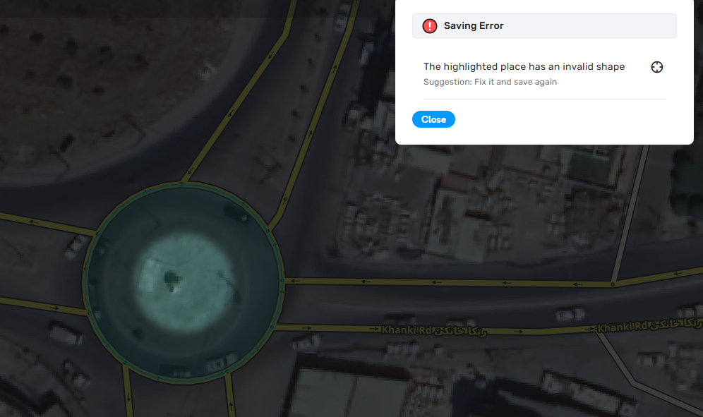
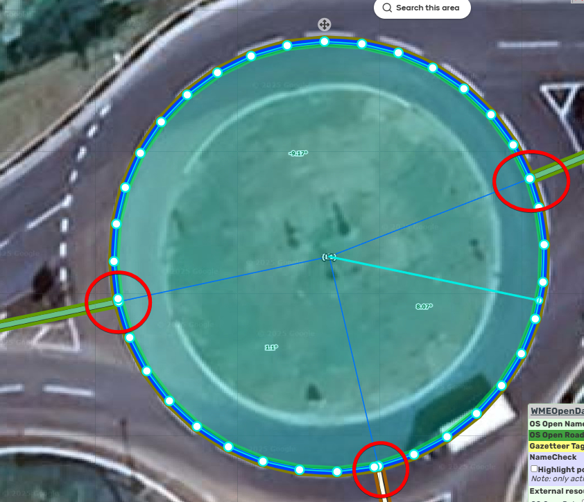
This issue seems to be due to how geometry nodes are being plotted where the roundabout segments intersect with connected road segments. If the geometry nodes around this area are removed, the area place can be saved successfully.
I think it’s possible they are overlapping, just at a level that is not obvious in the editor.
In France we have a publisher Zbouibe who has created a script to bypass this backup blocking.
You make the POI with TB, you call the script with Alt+T and you can save:
// ==UserScript==
// @name New Userscript
// @namespace http://tampermonkey.net/
// @version 2025-08-20
// @description try to take over the world!
// @author You
// @match https://.waze.com//editor*
// @icon http://waze.com/favicon.ico
// @grant none
// ==/UserScript==
(function() {
‘use strict’;
let wmeSDK;
window.SDK_INITIALIZED.then(initScript);
function initScript() {
wmeSDK = getWmeSdk({ scriptId: “fgdrg”, scriptName: “dgdf” });
    wmeSDK.Shortcuts.createShortcut({
        callback: () => {
            replaceTb();
        },
        description: "Corriger rond-point Toolbox",
        shortcutId: "clone_tb_rp",
        shortcutKeys: "A+84",
    });
}

function replaceTb() {
    const venueId = wmeSDK.Editing.getSelection().ids[0];
    function cleanPositions(points) {
        const unique = [];
        const seen = new Set();

        for (const point of points) {
            const lon = parseFloat(point[0]);
            const lat = parseFloat(point[1]);
            const key = `${lon},${lat}`;

            if (!seen.has(key)) {
                seen.add(key);
                unique.push([lon, lat]);
            }
        }

        const first = unique[0];
        const last = unique[unique.length - 1];
        if (first[0] !== last[0] || first[1] !== last[1]) {
            unique.push([...first]);
        }

        return unique;
    }

    const geo = cleanPositions(wmeSDK.DataModel.Venues.getById({ venueId }).geometry.coordinates[0]);

    const newVenuId = wmeSDK.DataModel.Venues.addVenue({
        category: "JUNCTION_INTERCHANGE",
        geometry: {
            type: "Polygon",
            coordinates: [geo]
        }
    });

    wmeSDK.DataModel.Venues.deleteVenue({ venueId });
    wmeSDK.Editing.setSelection({ selection:{ids:[newVenuId.toString()],objectType:"venue"} });
}
})();
Hi everyone! MoM has passed Toolbox on to me. Please contact me for any future Toolbox inquiries.
Chrome update is now available, Firefox within 24hrs, let me know if the auto update works.
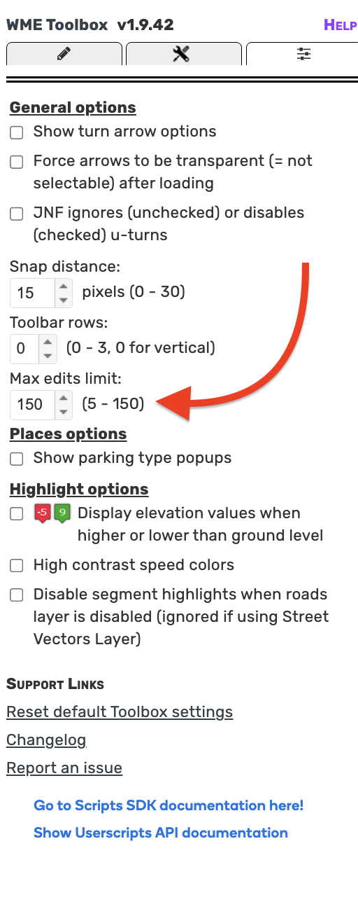
TB v1.9.43
- UPDATED: Country permissions for Brazil (more will be changing the update after this one)
- UPDATED: SM user list
- FIXED: Roundabout areas should now be working once again!
Let me know if there are any issues ![]()
Also I won’t be adding any new features until I have finished migrating it to the SDK (about halfway done). Only bugfixes and permissions maintenance for now.
I am keeping a list of all these suggestions and will eventually get around to considering/adding them.
3 Likes