if you have installed the script in chrome, before tampermonkey, unsinstall it. Then, go to the greasyfork script page, click on install, and process it with tampermonkey.
OMG IT WORKS LIKE MAGIC! Thank you sensei!
Impossible d’utiliser le script ce soir : la jauge reste désespérément coincée à 0%
Je retenterai ma chance demain.
I guess you’re trying to say that the script gets stuck at 0%?
Happens occasionslly, try moving around on the map a little before clicking scan.
Ok, thanks for the tip.
Can anyone tell me how to convert a file that i can open in qgis into wkt? i am trying to set up areas that are quite large, but not quite the whole state. When i scan florida there are 3k UR’s and i just give up working that many, and the script really drags down WME. I was going to divide the state into the 7 FDOT districts and work it that way. any info would be helpful.
http://osm.dumoulin63.net/osm2kml/ is what I have been using to convert a KML to wkt.
Is there a limitation of the number of coordinates that it UR-MP can handle?
Maybe there is something wrong with the formatting of my wkt file…
You can save the file as a csv and select the wkt type add an option of that (I can give specific instructions tomorrow, if needed). You’ll then need to manually modify the resulting file to remove a couple extraneous things (I compared the extract to one exported from this script)
I’ve just been doing this myself. You need to save it as a CSV, and choose the WKT geometry option.
You might need to edit the text output a little to match what the script expects (no header, only 1 column)
i’ve tried that a couple times now and even just drawn a simple polygon and converted it to csv and I’m still not getting any response out of UR-MP. I figured maybe that the river border alongside one of the counties was making it not work but its not loading a the area with less points than i used for a custom area from a POI. I also tried reducing the accuracy of the gps coordinates and still no dice. I appreciate the quick response. Any other ideas would be appreciated. At this point i’m just thinking about cludging around the map and just doing a POI area.
New Issue: with the new update that has allowed editors to see UR’s that are out of the Editable Area (EA) the UR-MP script can also see this and will show these UR’s on the list. For editors that have a majority but not all of a state, and run the state area in UR-MP, the non-editable UR’s will show up. Is there any way to show only UR’s in editable area on the results list as a filter?
The OK button for the date filtering is offscreen with no scroll bars. Have to tab to get to it.
@triage685: yes. Added to my todo list
@bummerdude69: this filter is not implemented yet. I forgot to remove the UI before the release. :oops: Anyway, thanks for the bug report!
Thanks guys for the help, I figured out my issue. I used your advice and got the WKT files. but what was holding me up was there was something wrong with UR-MP. I removed and reinstalled. and voila it works great again.
when I click on ‘scan editable area’ is the area that is scanned the editable area on my screen or is it ALL of my editable areas?
thanks.
It is all your editable area.
Ok. That tells me that one or more of my other scripts is interfering with URMP. I suspect this b/c others are closing URs that I responded to b/c I’m not seeing that they are still out there in URMP tracking.
This is the only filter I have enabled in URO+
http://prntscr.com/8jrigi
Any thoughts?
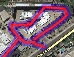
What if I scan my country, but some parts are left out, can this be fixed? How are country borders counted in script?
1 Like
@ramblinwreck_81: I don’t understand your problem. What are you seeing / not seeing? After what kind of event (someone respond/someone closed / …)/ action (manual scan / autoscan / …)?
@Olestas: borders are taken from a free DB. You can check a border with the googleearth export. If you want a more precise border, let me know.
1 Like
Yes, some parts are left out. How do we make more precise border for Latvia?
Interesting question Olestas, for us it doesn’t leave parts out, but it includes a small part of Germany that shouldn’t be in the Swiss scan. So I’m interested as well.
In your case I understand how it can be more of a problem though.
Can we edit the exported Google Earth file and modify the borders or is it read-only ?