Hi all,
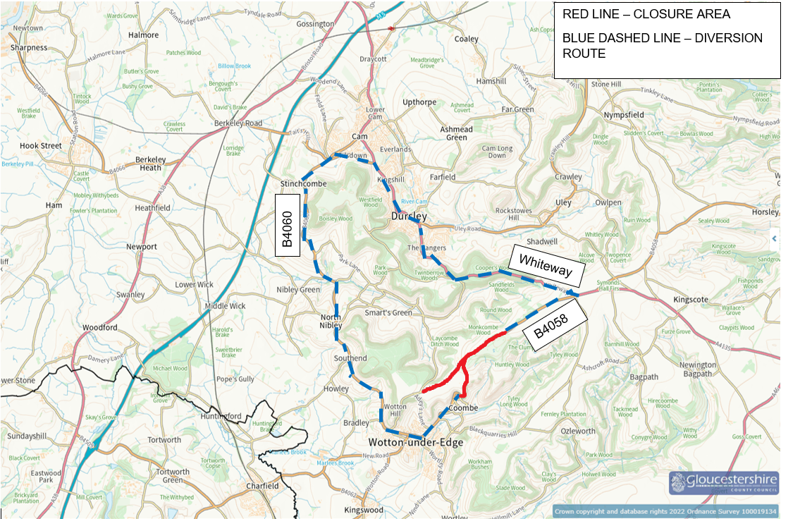
Urgent help needed! The B4058 is closed for 16 weeks minimum starting 6th Jan between what3words ///squaring.budget.pastels all the way through to ///unscrew.geology.flop, and also along Old London Road to ///gravel.curble.dupe (forward to the junction with the B4058 at //mostly.marriage.direction)
We have repeatedly marked this as closed within the app but it keeps reopening.
PLEASE NOTE - someone has partially closed the road but the closure is incorrect:
- The B4058 is OPEN east of the golf course (the map is currently showing the road east of the gold course to be closed)
- The road is CLOSED all the along the A4058 westwards to the first junction down into the Coombe. Additionally, Old London Road is closed from the junction after Adeys Lane all the way through to the B4058.
This is causing mayhem in our town with delivery drivers etc all becoming stuck at the road closure sign, which is on a narrow two lane single carriageway on the side of a hill, making turning impossible and needing them to reverse some distance.
The details of the closure can be confirmed here B4058 Rushmire Hill | Highways (if you click the diversion link on the left, it will show you the diversion and details of the road closures - links here https://www.gloucestershire.gov.uk/media/kl3bs4r5/tm-closure-final-diversion.png)
I’ve looked online but I need to be a level 3 editor to close the road. Would anyone possible be able to help or advise?
Thanks so much!
Steve