Waze for Cities
Your megaphone to hundreds of millions of Waze and Google Maps drivers
Waze for Cities: Your Partner in Safety and Mobility


Frequently asked questions
Waze for Cities is available to authorities that manage traffic or public infrastructure, including transportation departments, emergency services, road operators and other public agencies.
If you’re unsure whether your organization is eligible to join Waze for Cities, you may submit an application that will be reviewed by our team.
Major event organizers and venue operators are eligible to join our Global Event Partners (GEP) program.
To join Waze for Cities, you’ll need to create a Waze account and fill out an application here. Make sure to use your work email that is associated with your organization.
Once approved, you’ll receive an email with a link to Waze Partner Hub, where you can immediately start using Waze tools.
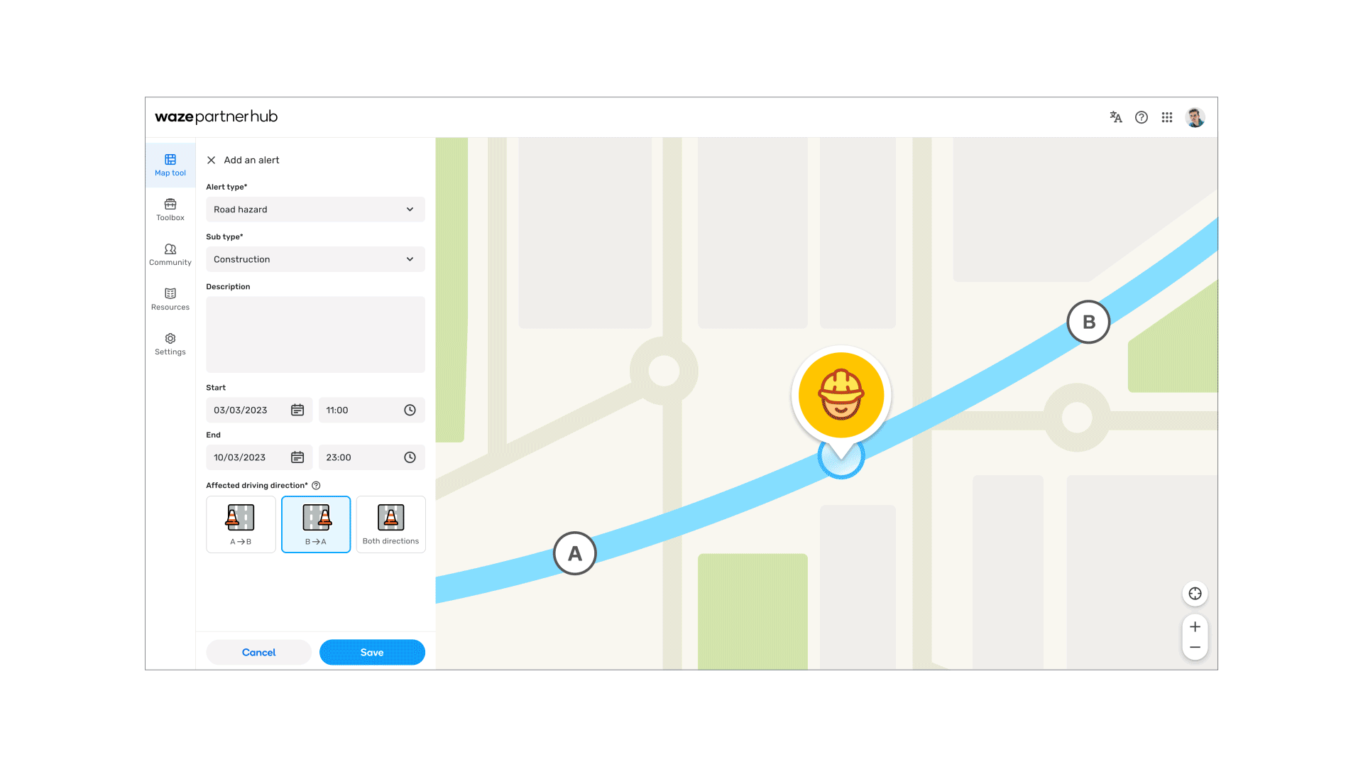
On Waze: Real time hazards and incidents such as crashes, construction, emergency vehicles and more.
Live and upcoming road closures, lane closures and major traffic-impacting events.
Additional map updates can be made through the Waze editor community.
On Google Maps: Road closures and supported hazard types submitted to Waze will also appear on Google Maps.
Additional map updates can be made through Google Maps Content Partners.
We believe the best mobility solutions come from working together, so Waze for Cities is offered free of charge.
Waze for Cities partners may use BigQuery to analyze up to 1TB of Waze data free of charge each month.
Google Maps, Google Transit, Google Maps Content Partners, Google Maps Platform, Google Environmental Insight Explorer, Google Earth.
