First of all, I would like to congratulate you on your participation in the activities created by the community itself. However, before starting any action, I think it is important that you contact the Champs so it can be verified if there is a need for alignment or further refinement in some guidelines.
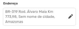
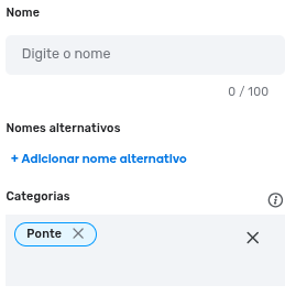
I am writing with some concern, because with just a few clicks in the places tab, it was already possible to identify several errors, such as places being created without the city being assigned. Patrick had already warned about this point about 14 days ago in this topic and, even so, the error continues to be repeated by some editors.
There are also high-level editors who are inserting the kilometer markers into the address.
This has already been pointed out by our editor @luluvixx and is a point that deserves immediate attention. We need to pause and analyze the situation before moving forward. The enthusiasm is great and the initiative is very valid, but it is fundamental that certain guidelines are followed.
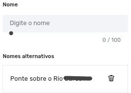
Another thing that needs debate is the creation of places in the bridge category with unofficial names, “Bridge over Waze River”? There hasn’t been a clear debate on this for an alignment of the entire community, but I have already seen 3 opinions.
Leave the primary name blank and fill in the unofficial name in the alternative;
Unofficial name in the primary;
Map only the River;
I believe the best path is to suspend the activity for now, align the necessary points, make the corrections, and then move forward.
@paulogustavoPI The guidelines on inserting the city name in places and not including mileage in the address field are described in Wazeopedia. If there is interest in debating these topics, the ideal approach is to open another thread to keep the focus of the discussion. If necessary, the Champs can analyze the possibility of making adjustments to Wazeopedia.
For now, I believe the debate should focus on how to act when bridges have unofficial names, such as “Bridge over the River”. If there is another relevant topic, please let us know.
I also consider it valuable for everyone to participate and contribute opinions that help enrich the Champs’ debate.
Bridge over the _____ River doesn’t seem useful to me; there could be several bridges over the same river, imagine the confusion. I believe only the official name should be valid. And as for including the city name in places, I’ve been doing that for a long time now, because even if it’s in the interior, the user needs to know the city—it appears in the search.
I see things a little differently; “bridge over the … river” is useful in my view, as long as the city is registered in the place.
We know that many bridges on highways outside city limits don’t have official names, only signs identifying which river the bridge is over, which in my view acts as a reference point. And yes, this river will pass through several other highways or cities, which is why it’s important for the city name to always be registered.
Just to be clear - based on what’s been presented so far, the guideline is:
Name: do not use a descriptive name (“Bridge over the … River”);
City: always include it.
When I was mapping the rural area, I sometimes left out the city (but was planning to add it later). I’ll align with the community guidelines and make the necessary adjustments.
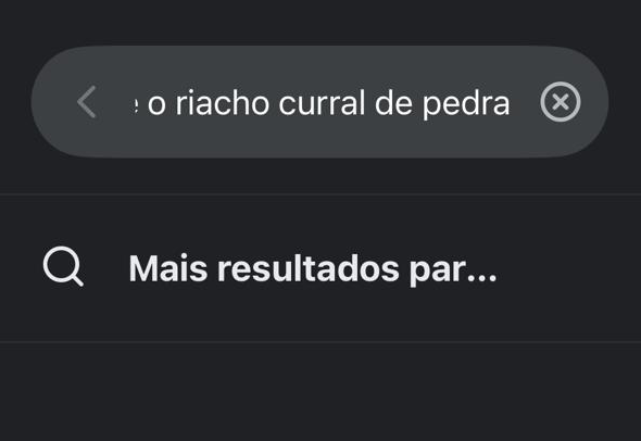
Just let me ask a sincere question: in what situations will the app user be able to see the city name if the bridge doesn’t have a name?
The difficulty in mapping bridges is knowing which city they are in and not having to guess in some cases.
While I’m at it, I’d like to ask a sincere question: how important is it to dedicate time to mapping bridges that don’t have official names? Do they represent a truly relevant point for mapping?
In these cases, wouldn’t it be more appropriate to just add a comment indicating the kilometer marker of the stretch?
Hi Bruno!
There are bridges and overpasses with official names created by law.
On federal highways, you can check the Names on Federal Highways topic and other traffic/highway-related topics right below in my signature.
And as already advised by Wazeopedia, just add the official name created by law to the segment.
Regarding the matter of places, follow the Wazeopedia recommendation.
In short, if the bridge name is missing, it doesn’t make a difference whether or not you include the city name.
Speaking for myself: I was one of the proponents of this request to the DNIT.
My goal has always been to identify vulnerability points in the road network. Whenever I see news about bridge closures or flooding spots, the reference is usually the name of the river or stream. Having these points already mapped makes any potential alerts much easier. Additionally, it helps the editor notice these key points to handle the surrounding area more strategically.
I would be satisfied just identifying which are the truly relevant rivers that cross the highway and tracing their paths in the area near the road. This adds visual reference points for both the editor and the driver.
Adding a comment with the kilometer marker is another benefit, as it’s another relevant reference point — in this case, only for editors.
Adding the bridge itself was not part of my original plan, but it was added to the task later. I joined the proposal because I also consider it a benefit, but I will follow the community’s definitions.
I would like to clarify some points and take the opportunity to raise other questions to be aligned between the community/champs.
And why (not) map?
As an editor: anyone who participates or has participated in Road Closures, Crisis Response, or unexpected and unplanned disruptions knows the importance; a quick search is enough to see the number of incidents that occur on bridges, and we also cannot fail to take these traffic events into account.
As a Wazer: for someone who uses the app only for the “Home-to-Work” commute, it might not be of any use at all, but for those who need to arrive quickly to perform a Rescue (Federal Highway Police (PRF), Ambulance, Firefighters, National Department of Transport Infrastructure (DNIT), Civil Defense) — just like when we mapped several health units (Basic Health Units (UBSs), hospitals, Emergency Care Units (UPAs)…) and then a pandemic hit shortly after — it can make a vital difference.
I also believe that if it weren’t relevant to “Waze,” they would have already removed “Bridge” from the list of Categories.
Returning to the questions… since we ALWAYS have to include the name of the CITY, in cases of other Places (River and Sea, for example) that pass through several cities/states, which city should we use?
There are others, but for now, I’ll stop here.
In any case, I appreciate everyone’s participation and collaboration in order to enrich and improve the edits.
Based on your request, the Champs held an intensive session to normalize the mini raid and reached a consensus after a debate, taking into account the points raised by the community. It was decided that places in the “Bridge” category should not be created when there is no official name.
The importance of mapping is clear when talking about crisis situations; however, for the end-user, this type of place ends up not being useful. First, because it is not a common destination; second, because visually, in many cases, the name only appears depending on the size of the drawn area, and the river place itself overlaps the location.
The issue was also raised that some rivers can be extensive and have several bridges, which would result in multiple bridges with the same name, potentially causing confusion.
Suggestion: want to map with crises in mind? Use comments and, if necessary, check via the dashboard.
You can release the spreadsheet again for correction. If possible, create an extra column to mark what has already been reviewed. If you need help, just raise your hand
Don’t forget to correct cases of bridges that do not follow Wazeopedia and, if there are any that do comply, ensure they are mapped correctly according to Wazeopedia.
OK, Gabriel, thanks for the reply. I even suggest that this decision be recorded in the Wazeopedia.
I also note that this is a specific rule for bridges — it doesn’t necessarily apply to all places. For example, rivers and lagoons can be represented on the map even if they don’t have a name.