Can anyone tell me if some WAZE roads should be changed to match the signage and the state of Delaware’s official names for these roads? If so, Google should be informed as well, though I don’t think there are currently any addresses on this stretch of road:
Here’s why I believe this to be so:
https://www.waze.com/editor/?env=usa&lon=-75.55353&lat=39.78357&layers=1957&zoom=8&nodes=58797141
At this node, Powder Mill Rd/141 comes in from the NW and exits to the NE.
Childrens Dr. comes in from the SW. And to the SE is SR-141 spur.
And again, as you approach the spur from W Park Dr: 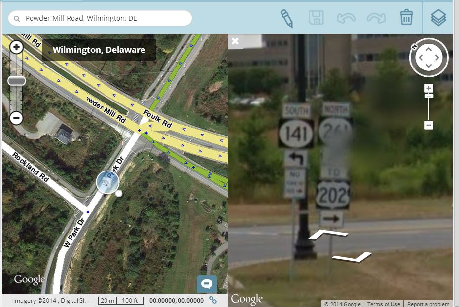
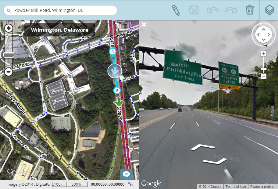
Again, if you check the view from 202 https://www.waze.com/editor/?env=usa&lon=-75.54616&lat=39.78417&layers=1957&zoom=6&segments=69929716
You can see that the exit sign is for SR 141, not for powder mill road
So it looks to me like
https://www.waze.com/editor/?env=usa&lon=-75.54935&lat=39.78035&layers=1957&zoom=5&segments=68388486,68388485,63778975,68388480,68388481
should all be called Rt 141 spur, and lose the Powder Mill road designation.
So I think that
https://www.waze.com/editor/?env=usa&lon=-75.54494&lat=39.77842&layers=1957&zoom=5&segments=71853351
Should be SR-141 spur.
And that https://www.waze.com/editor/?env=usa&lon=-75.54497&lat=39.77842&layers=1957&zoom=5&segments=71853354,61305956
should be broken apart on one side of the flyover or the other, and everything to the W of the divide should be SR-141 spur, and everything E of 202 should be Foulk Rd/SR-261
My recollection is that, before the spur was built, Foulk road ended in a T intersection at route 202 at approximately the spot it now hits 202, but that was many years ago.
Does that make sense?
