[Script] WME Fast Menu ( all in one right click menu )

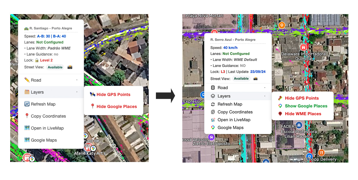
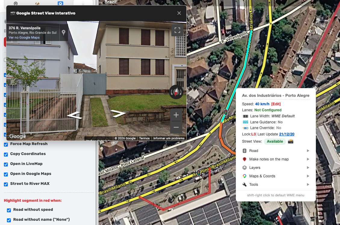
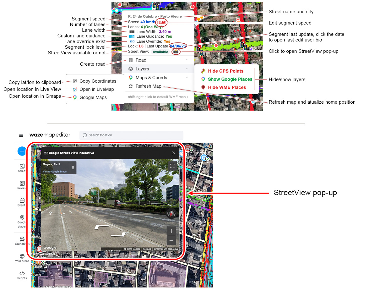
WME Fast Menu adds a contextual menu to right-click (it can be configured to the middle button)
Adds access to items that require more than one click to view the information.
Add useful shortcuts, open the location in Live Map and Google Maps, refresh the map, and other functions.
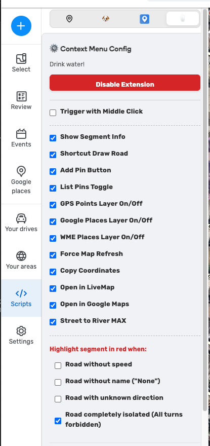
The menu can be customized / disabled through the </>Scripts tab menu.

TOOSL MENU:

  • Street to River Modified ( with undo and floating menu )

p.s. to access a WME default right-click menu use shift right-click

translation disponible in pt-BR, JPN, ES, FR

LINK to Extension HERE

Menu overview below:

Changelog:

• 0.9.7

  • Street to River MAX geoJson bug fixed

• 0.9.6

  • add tools menu
  • add modified version of Street to River PLUS (mod) script inside tools menu.
  • minor code improvement

• 0.9.1

  • fixed: Google Places layer was not hiding the text layer ( reported by @andres_twins thanx ).

• 0.9.0

  • Add lane override information
  • Add edit segment speed ( requested by @LeoGregol )
  • Maps & coordinates combined into a submenu
  • Added icon similar to the WME Lane functions to improve readability.
  • Known bug: lane override info doesn’t work in some languages.
  • Known bug: some words are not being translated correctly.

• 0.8.5

  • add hide/show WME Places
  • add segment last update date and who edited last ( clicking on the date opens a new tab with user bio )
  • change emojis with custom icons
  • UI taking up less space

• 0.8.4

  • implemented autodetect imperial/metric speed display
  • adjust the segment speed visualization to only display valid speed. thanx @abc1357

• 0.8.3

  • First public release

Nice!

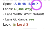
Is it possible, if WME is set for Imperial units, to display the segment speed in MPH, instead of km/h.

Also, for 1-way segments, is it possible to remove the speed in the non-travel direction instead of displaying a ?

With just two clicks, I’m already a fan! I’ll let you know if I have any other suggestions. Excellent job, @daflash !

Thanks @andres_twins ! If you have any suggestions, let me know.

Thanks @abc1357 for the report, I had completely forgotten about the metric/imperial flag.

I’ve already implemented the mph/kph visualization in the extension ( version 0.8.4 ) and adjusted the speed display to only show the valid speed of the segment.

I will update the first post with a changelog.

THANK YOU.

Both fixes worked perfectly.

Hi,

I made some minor adjustments to the extension.
I slightly reduced the spacing to better accommodate small monitors and added some new features, edited the changelog in the first post.
Also made custom icons instead using emojis to optimize the size.

Updated extension

Some layout changes and added Lane Override information. Responding to @LeoGregol request, the option to edit segment speed directly from the menu has been added.

Full changelog in the first port.

Great script - long-needed!

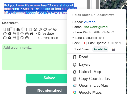
When right-clicking on selected text in this UR, the generic “Copy” should be available .. sometimes the doesn’t work.

Hi

To access a WME default right-click menu use shift right-click, this gives access to copy, past, etc. But it’s a good idea to include a copy/paste function (which should be 90% of right-click usage, I guess) directly in the menu; I’ll think of a way to implement that.

thanx!

Hi @daflash
Today this happened to me: when I hide the places on Maps, the names are still visible

Regards

@andres_twins thanks for the report. I will investigate what happened.

Hi @andres_twins bug fixed.
The fixed version is 0.9.1
It has already been approved by Google, it should update in the next few hours.

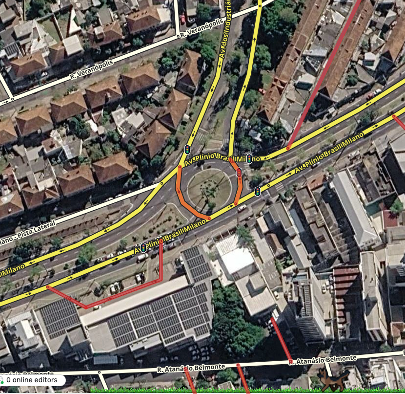
I added the “Tools” menu, and the first script I added is one I use frequently called Street to River plus (mod).

It’s a customized version with additional options like undo, the ability to change the geometry and width afterward, and I also migrated it to geoJSON and started migrating the script to use the SDK.

I’ve attached a video below showing it in action.

Fixed a bug in the TOOL → Street to Rive MAX affecting certain geometries where points would disappear and fail to form the river.

The current version is 0.9.7

Update do VERSION 1.0

2 new feature has been added in this version:

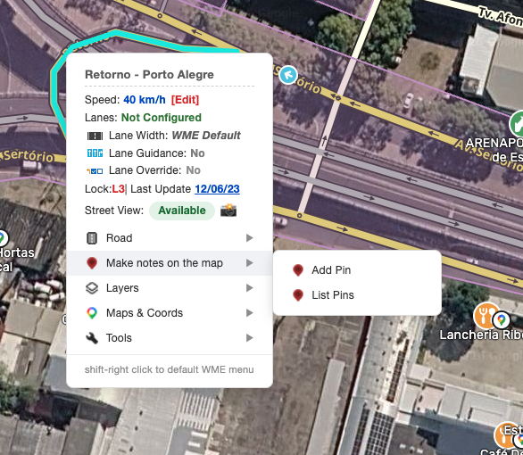
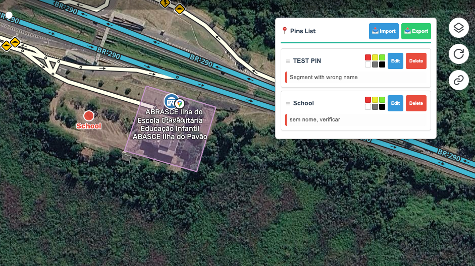
The ability to add annotations to the WME map.
You can now create map pins with notes (e.g., “Check in 3 days if the change worked…”) and use color coding to easily track status. Also added the option to export these pins as a .json file so you can use the annotations in another browser.

Highlight options for road segments have also been added (in the tab menu):
  • segments without speed data
  • unnamed streets (“no name”)
  • segments without direction (like in Japan)
  • completely isolated segments

Some minor bug fixed

Hi, version 1.0 solved this problem.

The menu not active over text box or UR menus