TL;DR: Revamping Waze Crisis Response User Communications for Mandatory Evacuation Zones
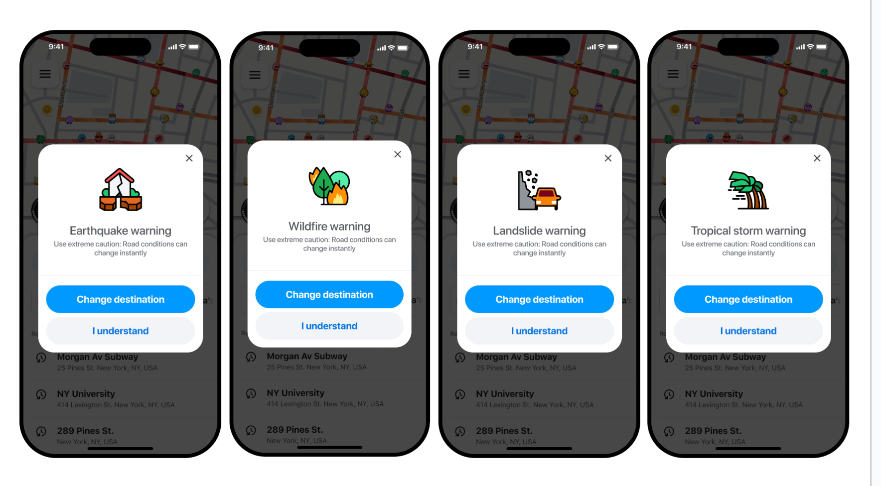
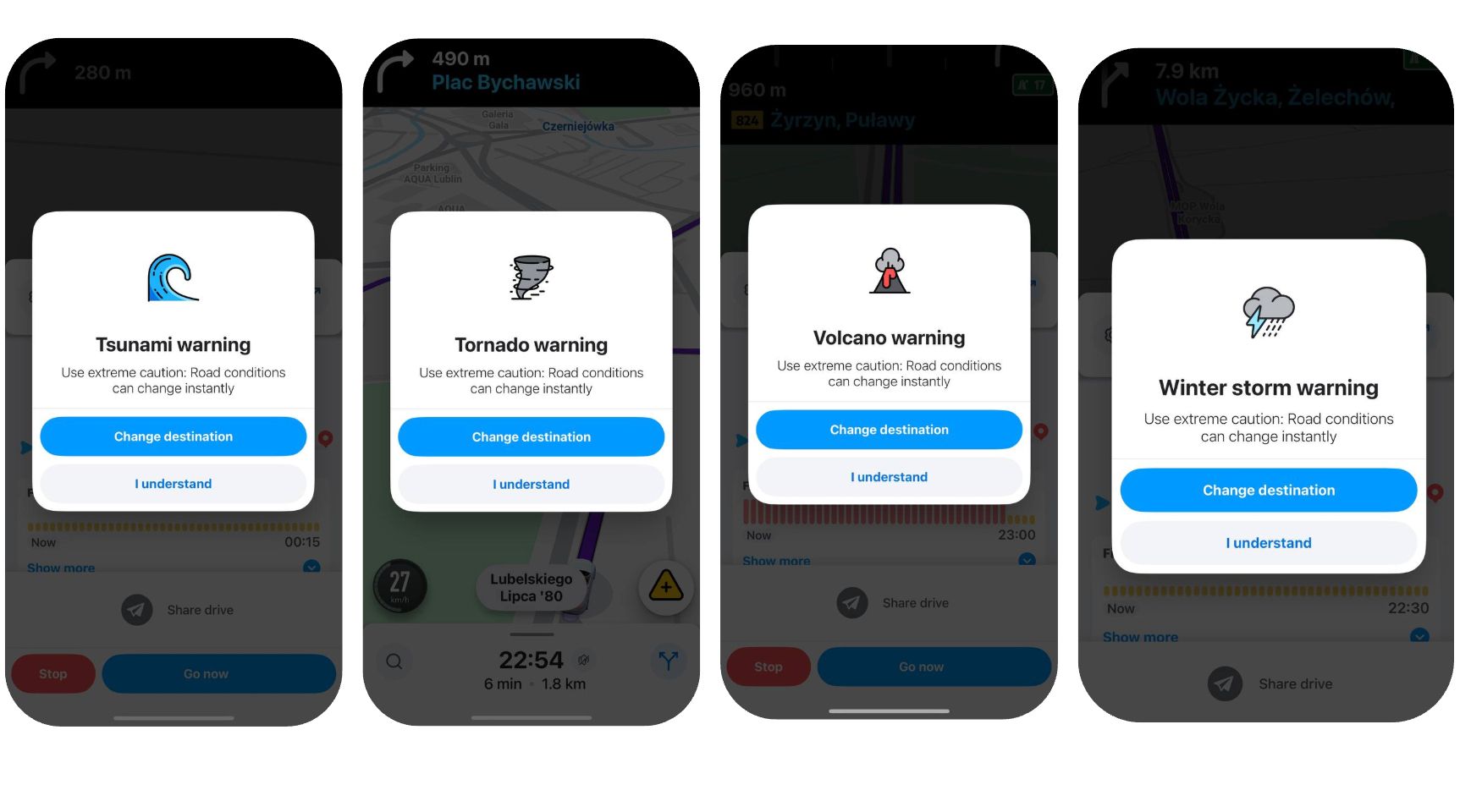
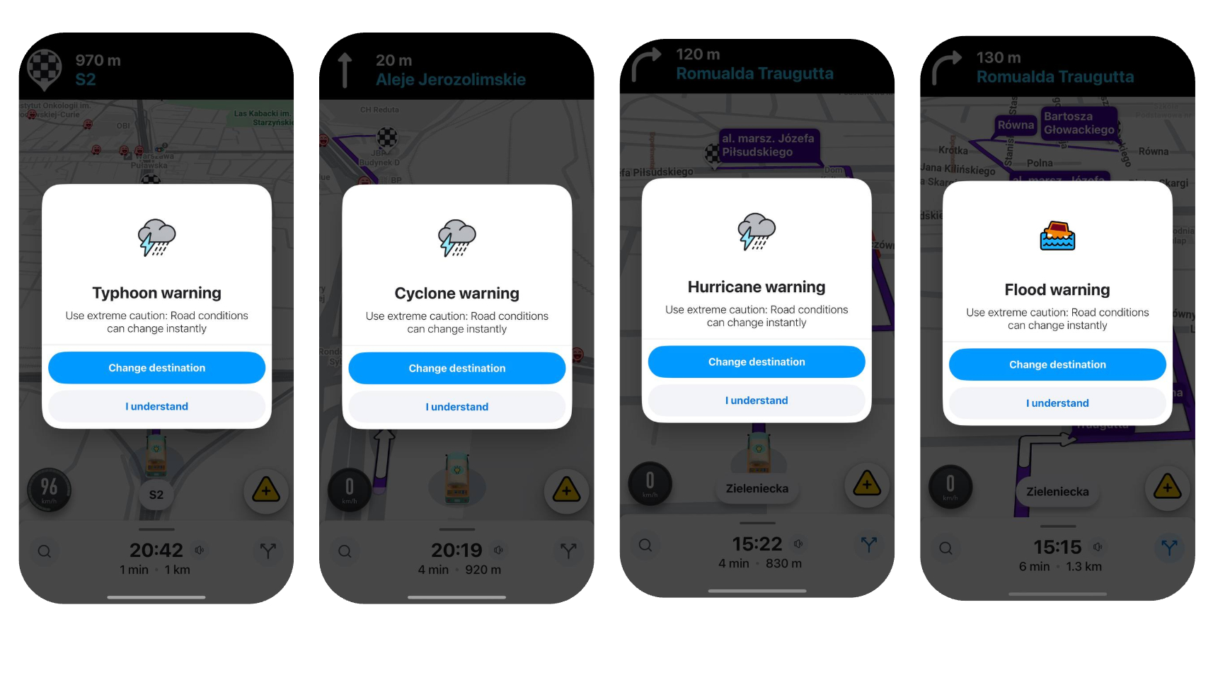
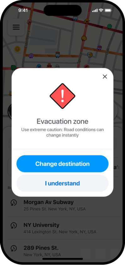
Waze crisis communication notifications are designed to provide rapid, timely updates to users who may be affected by a crisis in their area. This project focused on refreshing the messages and design to make them clearer and more engaging for users. The new notifications are now LIVE!
The alert for an evacuation zone is determined by a polygon area and is now specific to each crisis type.
The Waze team uploads a KML file, received from the community or partners, which outlines the specific area coming from an official government source.
This action then triggers an alert for any user whose destination falls within that designated zone.
We’re always here to support you. If you need to report a crisis in your country, you can reach out 24/7 to waze-crisis@google.com.
You can also sign up to be a first responder to help us make a direct impact on Waze users.
A big thank you to all the community members who help and support during these times. Your dedication provides an essential safety route for users.
The alert for evacuation zone/wildfire/tropical storm and more warnings is determined by a polygon area.
The Waze team uploads a KML file, received from the community or authorities, which outlines the specific area.
This action then triggers an alert for any user whose route or location falls within that designated zone.
Are these pre loaded polygons? We have a lot of wildfires in the western US and as a coordinator for that region I don’t recall any polygon requests. Is there a way we can have visibility to the polygons?
Can you give an idea of the time-frames required for the process?
For example, if we have a tropical storm warning expected to hit an area in a day or two, is that sufficient? Does it require a tile update to reach users?
Similarity, if we have a crisis with no warning, how long is the turn around to get it activated? Or removed once the crisis abates?
Thank you for sharing. It’s great to see enhancements such as these. Can the RCs get a current list of ‘First Responders’ for their areas or for the country so we can review and confirm the list is still accurate and up-to-date? I know there are some in my region that get copied on Crisis emails that are no longer actively editing.
Sorry for the miscommunication. I meant: if we have a crisis that occurs with little to no lead-up or advanced notice, how quickly can we move to add the polygons. But you clearly answered that with your reply.
I appreciate the additional details you were able to provide.
A follow-up and update to the folks following this thread, and the community at large:
Apparently, the above text from the original post was not meant to indicate any willingness on behalf of the crisis team to the use any of the of new user communications templates for any circumstance other than a mandatory evacuation.
I attempted to request a Hurricane Warning user communication for the impending landfall of Imelda on the island of Bermuda, however, because Bermuda was not under a mandatory evacuation, no Hurricane Warning User Communication would be sent by the Crisis Team.
I’ve be assured the release post will be updated to make this policy clear.
My questions are:
What was the point of creating all these situation-specific user comms, if the only situation one available for use is during a mandatory evacuation?
If there is a mandatory evacuation, none of the other user comm examples have language mentioning a mandatory evacuation, so how would a user know that they were routing from/into a evacuation zone?
How many of the example crisis actually result in mandatory evacuations? I can’t think of any Tornado or Winters Storm warnings that require a mandatory evacuation zone.
Yes, i got the same reply from the crisis team when I requested for the summer storm warning which carry a high risk of floods and landslides due to our landscape in Nepal. The evacuation is rarely a case in Nepal besides earthquake and flood, which is carried out after the impact.
They mentioned that the current alert system is exclusively for evacuation orders. They clarified that it is not intended for issuing proactive warnings or advisories.
Utilizing this system to issue advance warnings and advisories would be an invaluable tool for improving driver safety on the roads.
My apologies for the delay in responding to this feedback as I was on a holiday.
Thank you for raising these important questions—it highlights where we need to be clearer.
Here are the immediate actions:
Post Updated: I’ve updated the original post to state explicitly that the new user comms templates are reserved only for mandatory evacuation zones.
Scope Review: I hear you regarding the need for communications in other severe weather events (like Hurricanes, Tornadoes, etc.). I am now actively exploring the possibility of expanding support beyond mandatory evacuations.
Language Feedback Shared: The specific feedback on making template language clearer (especially for routing into/from an evacuation zone) has been shared internally with the relevant team for review.